An Insider’s Guide to Amazing Newfoundland Hiking

We love introducing new outdoor spaces for you to explore, and we’re very excited about this one. We interviewed Katie Broadhurst of Outdoors and On the Go about hiking and backpacking in Newfoundland. This remote island is part of the Canadian province of Newfoundland and Labrador, the most easterly point in Canada, and is separated from the mainland by the Strait of Belle Isle.
Katie is co-author of the guide book Hikes of Newfoundland. Her deep knowledge of hiking comes from both personal exploration and well as guiding in the area. Keep reading for everything you need to know about exploring Newfoundland, an off-the-beaten-path nirvana for hikers, backpackers, and outdoors enthusiasts who want to see a little bit of everything. It is the ultimate destination for adventure travel.
This rugged locale has something for everyone, but the bigger hikes are best enjoyed with the right physical preparation. If you need help getting in shape to tackle a hiking trip in Newfoundland, check out Fit For Trips’ custom fitness programs or schedule a complimentary fitness consultation with Marcus Shapiro.
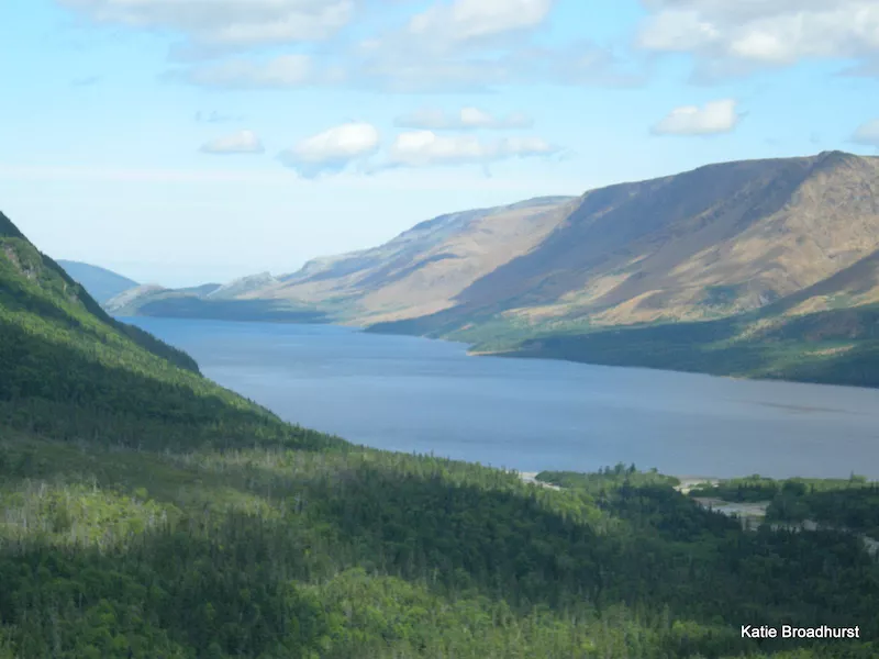
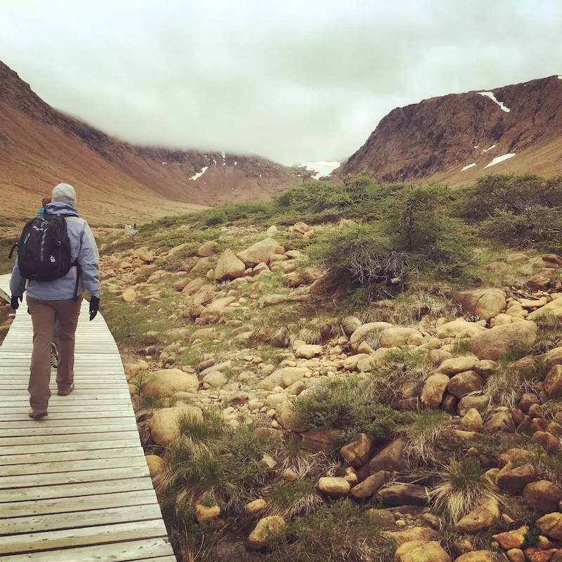
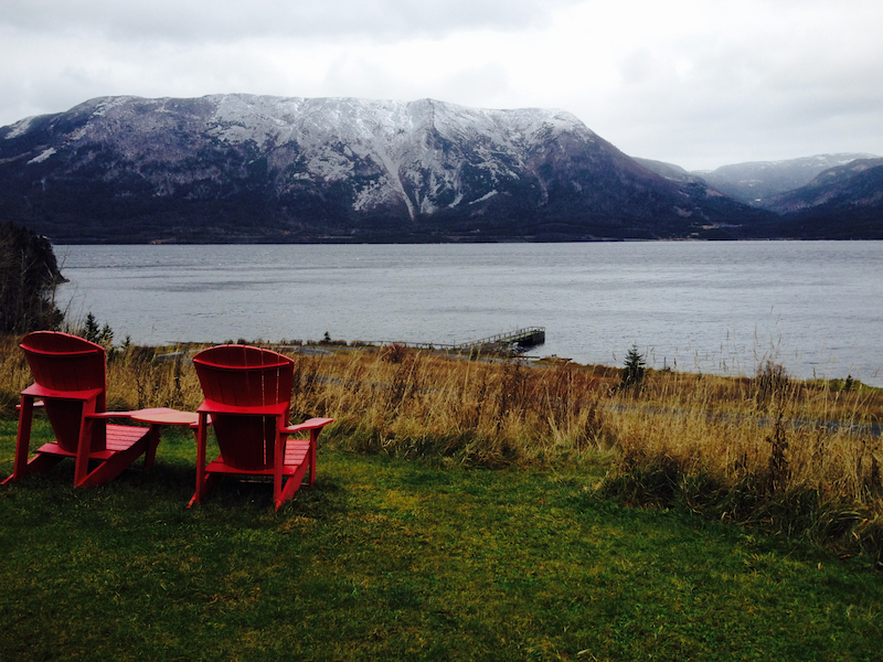
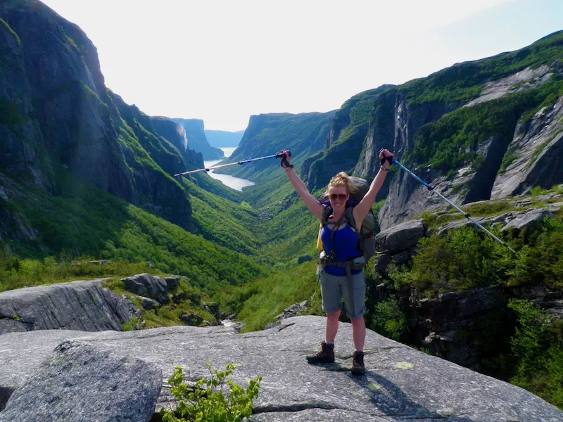
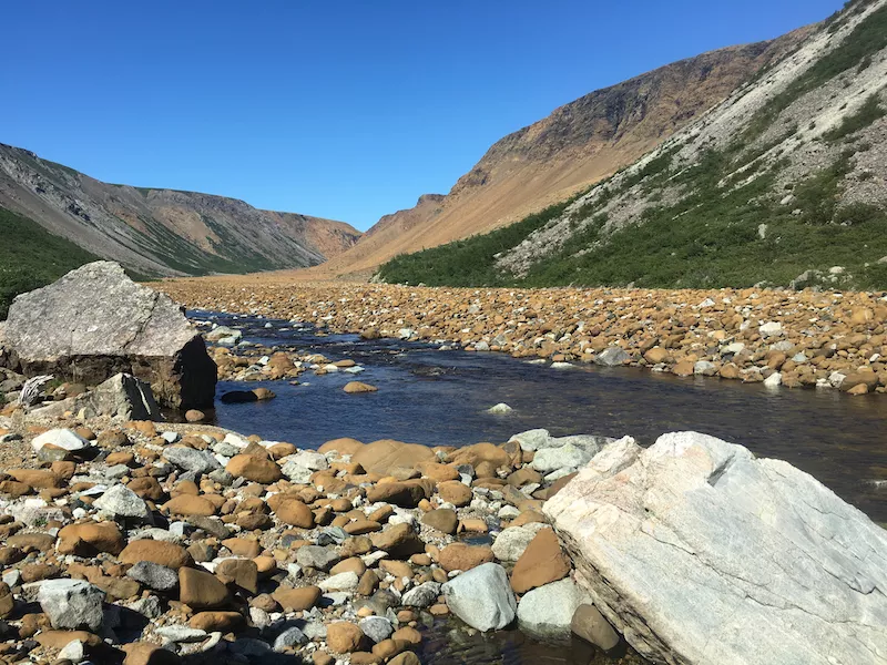 Blow Me Down Mountains
A primer on Newfoundland geography, geology, and wilderness
Newfoundland is a large island off the coast of Canada, and since it’s off the beaten path, people underestimate its adventure potential. Despite being home to a population of approximately a half-million people combined in the province of Newfoundland and Labrador, Newfoundland itself is mostly uninhabited beyond small, rural communities.
The entire West Coast of the island is rimmed with ancient mountain chains which are a continuation of the well-known Appalachian Mountains, home to the Appalachian Trail in the US. The International Appalachian Trail (IAT) organization has a chapter in Newfoundland that has been developing trails over the last 15-20 years to extend the Appalachian Trail north into Canada, through Newfoundland, and even into parts of Europe.
People call Newfoundland wild because of the remoteness and rugged, rough terrain. It is harder hiking than some people might be used to. Hikers really “earn your turns,” as they say, going over boulder fields to climb to these spectacular lookouts where you’re looking over ancient fjords and entire bays dotted with islands.
Another reason Newfoundland is considered wild is because there are some geological features on the West Coast, called ophiolite complexes, which can be found in only two or three other places on the entire planet. As a result, it looks like you’re walking on Mars because the red, iron-based rock is unearthly looking. It’s called peridotite. There are four of these ophiolite mountains on the West Coast of Newfoundland, and they are just spectacular for hiking because there are no trees. The views are epic.
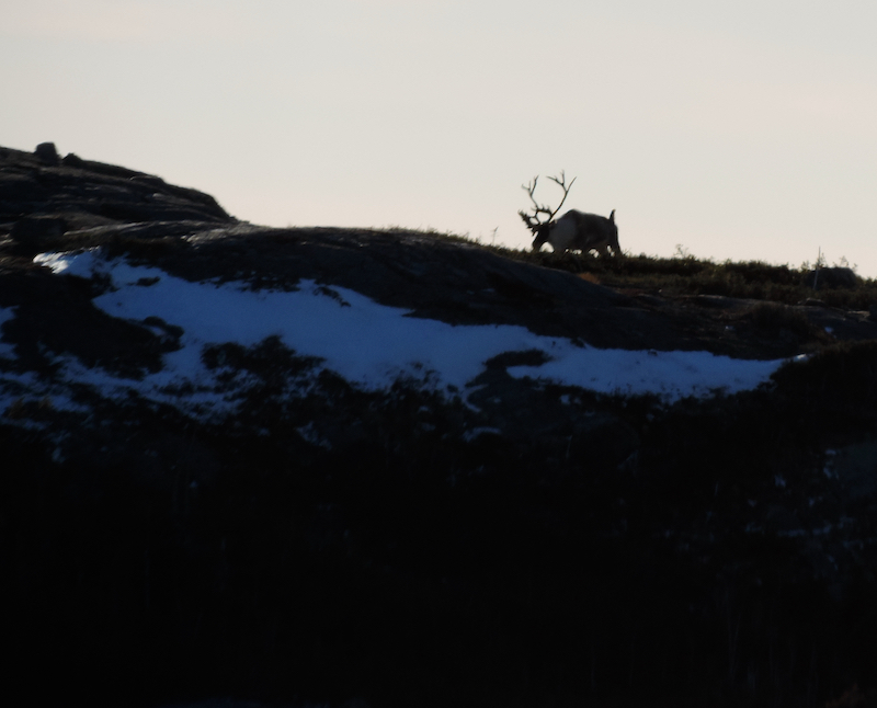 Caribou in Humber Valley – western part of the island of Newfoundland.
Top 3 Tips for Hiking in Newfoundland
- Bring rain gear. You’ll want a waterproof jacket and pants, not just water resistant, and you’ll want your jacket to have a well-fitting hood. Your rain gear will double as wind protection, which is useful in Newfoundland.
- Wear hiking boots. Even on some of the beginner trails, unless it’s a boardwalk, the rocky terrain is going to make it easy to twist an ankle. Plus, it’s wet, so having dry, comfortable feet will make the experience much more pleasant.
- Hike prepared. You need to bring a pack for all of the essentials. You’ll need layers, you need your whistle, you need your own first aid kit, you need a basic map of the trail or the area. Plus, bring water, snacks, and an emergency blanket. Even the beginner trails take you into no-service areas, sometimes quite far into these no service areas that aren’t easily accessible for aid or rescue. Either you’re walking out or they’re helicopter-lifting you out, so please be a responsible hiker and be prepared.
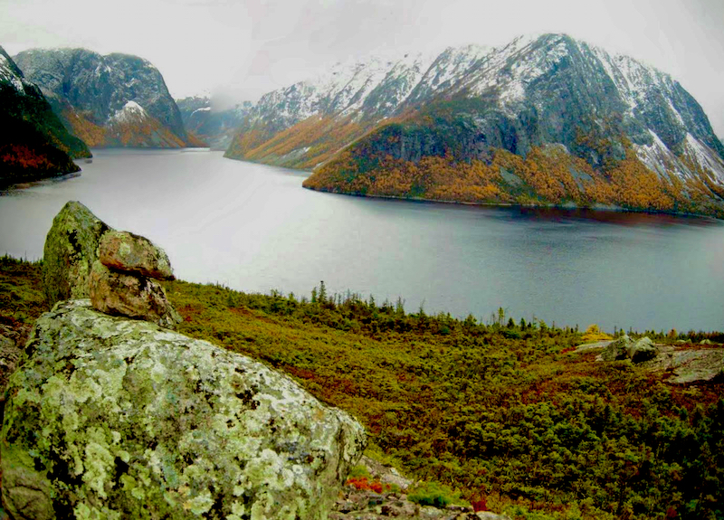 Views from the Devils Bite Trail behind Parsons Pond.
For people who are interested in flora and fauna, Newfoundland is an excellent place to visit. You’ll see lots of caribou, moose, and bears, plus lots of unique and specialized vegetation, including tiny flowers and fungi. The northern coast is home to a species of Arctic orchid, and Newfoundland is the most southern point where they exist in the world.
Newfoundland also feels wild because of the high probability of spotting whales, puffins, and even icebergs when hiking along the coastline. They flow down in the Labrador current from Greenland and drift by the northern coast. There are some spectacular hiking trails, both day-trips and multi-day, along the coastline where you can enjoy an iceberg sighting during the months of May, June, and July.
Newfoundland’s Top 5 Hard Hikes and Backpacking Adventures
These suggestions are based on a variety of factors, including overall distance, number of days to complete, technical terrain, and even just effort.
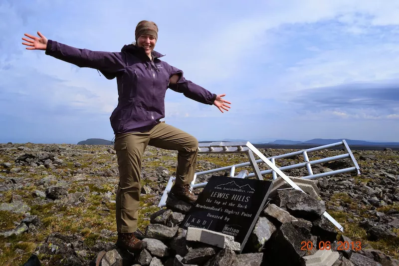
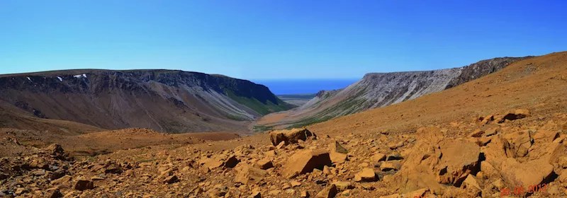 Rope Cove Canyon in the Lewis Hills mountain range.
1. Lewis Hills. This is a 3–4-day wilderness backpacking trip in Newfoundland with some navigation skills required. It will take you to the highest point on the island [812m/2,664ft], The Cabox, which is fabulous in and of itself. Here you’ll get some of the best options for terrain, spectacular views, and it’s a premium place for viewing caribou.
 Tablelands and Trout River Pond from the International Appalachian Trail UltramaTrex route.
2. UltramaTrex. This 145km/90mi trail goes by all four of the ophiolites of western Newfoundland, including the Lewis Hills, Blow Me Down Mountains, North Arm Traverse, and the Tablelands. It is a serious undertaking that requires 10-14 days to complete.
3. Long Range Traverse. This trek is inside Gros Morne National Park. It requires a permit, a park pass, and a ferry boat shuttle to get to the trailhead. It’s an iconic hike, sort of a classic, because it regularly gets featured as one of the top ten best hikes in Canada.
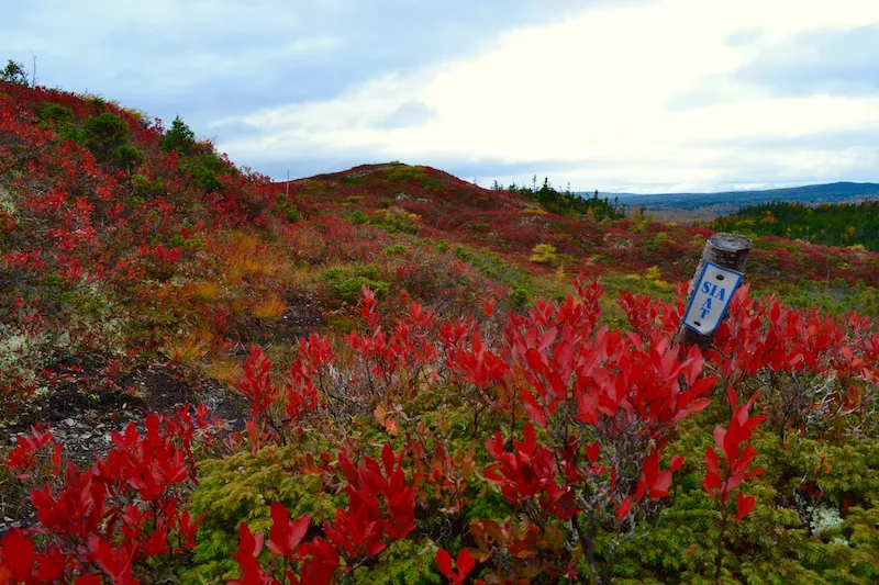 Fall Colors in Southern Newfoundland.
4. Grand Codroy Way. This is another lovely, multi-day hike, and that one would be the most beginner-friendly, overnight hike for someone who has some camping and navigation skills and is ready to make the switch to backpacking. Hikers enjoy climbing up to a lush, grassy, beautiful plateau with waterfalls and alpine lakes. You’re basically hiking along the coast, but you’re up high and just like slightly inland, so you get epic views of the lowlands and ocean.
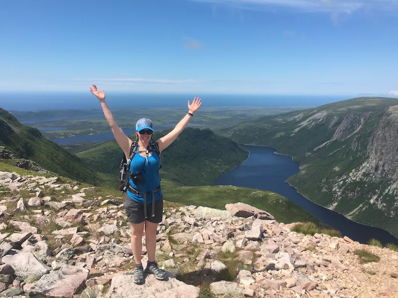 Katie on Gros Morne Mountain Summit with Ten Mile Pond in background.
5. Gros Morne Mountain. This one is a harder day hike at 16km/9.9mi within Gros Morne National Park. It’s not long or high by most hikers’ standards, but the rugged terrain and the wind gets people, so it’s generally not considered a hike for beginners, especially since it’s remote and there’s no phone service, so getting help is difficult.
What is it like to hike in Newfoundland?
It’s sort of boulder-y. We’re not talking rock climbing – there are no ropes involved. We’re not even really talking scrambling, like you would experience in places like the Rockies. You’re kind of just walking over boulders. Although, you can find some trails with scrambling in Newfoundland. Gros Morne Mountain is a really popular route inside the national park and it has what the East Coast calls a “scramble,” but it’s not the same as the Canadian Rockies and it’s totally different.
The highest point on the island is 814m/2,670ft. Elevation gain is low, but you’re hiking on rugged and exposed coastal terrain. Because of the low elevation and high moisture, the trees are dense. We call them Tackamore, which are spruce trees that are stunted by the wind. Bushwhacking is a terrible endeavor that you best not undertake when not needed. The challenge with Newfoundland is that not only is it rugged, it is super remote and there are a lot of places where there’s no cell service, so it’s best to stay on the trail.
Which is better: hiking Newfoundland’s East Coast or West Coast?
It depends on what you’re looking for. If you’re more into cultural immersion and want access to great food and easy transportation, you need to be in St. John’s. If you like the idea of hiking from town to town with access to amenities, the East Coast Trail is great for that.
East Coast pros: The trails are very well developed. The East Coast Trail organization has done a phenomenal job of developing a nice, multi-day and long-distance hiking routes, that are also, of course, hikeable by section. It connects a lot of the historical communities along the coast and features rolling terrain, beautiful cliffs, and nice views.
East Coast cons: The weather is bloody awful. It’s foggy and it rains there a lot.
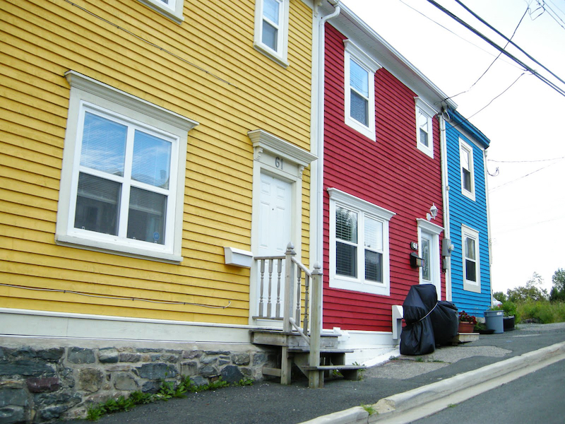 Row houses in St. Johns.
If you’re looking for elevation gain, unique geology, and a more remote feel, you’ll head to the West Coast. Here you will not be hiking through communities, so you’ll see fewer people. Gros Morne National Park is home to a variety of trails, and you can see that unique, Mars-like peridotite in an area called the Tablelands. Gros Morne Mountain is the highest point in the park and the second-highest point on the island, standing at 807m/2,648ft. You’ll get to experience plateaus, fjords, high-alpine lakes, and waterfalls. It’s a completely different experience.
West Coast pros: Elevation gain, more varied terrain, and spectacular scenery. You can spend several days exploring in and around the national park on a variety of trails.
West Coast cons: It’s a long drive from more populated areas of the island, such as St. John’s.
 Tablelands Mountains behind town of Woody Point.
What’s a great itinerary for a beginner hiker exploring the West Coast of Newfoundland?
I highly recommend a tour of the Northern Peninsula over at least five days, but six would be more comfortable. Just know, you need a car to explore and hike on Newfoundland’s West Coast. There is no other way, unless you want to hitchhike. Hitchhiking is doable, and the locals will pick you up, but it takes a long time and most people don’t want to do it. It’s best to take the 8-hour ferry to Newfoundland and drive to the Peninsula, or fly into Deer Lake and pick up a rental car.
 Woody Point and the Tablelands Mountains viewed from Norris Point.
Day One
Drive north on Route 430 to Woody Point, on Bonne Bay, inside Gros Morne National Park. I highly recommend a visit to the Discovery Center and taking a guided tour of the Tablelands to see that peridotite rock and get the full value and importance of this geological feature.
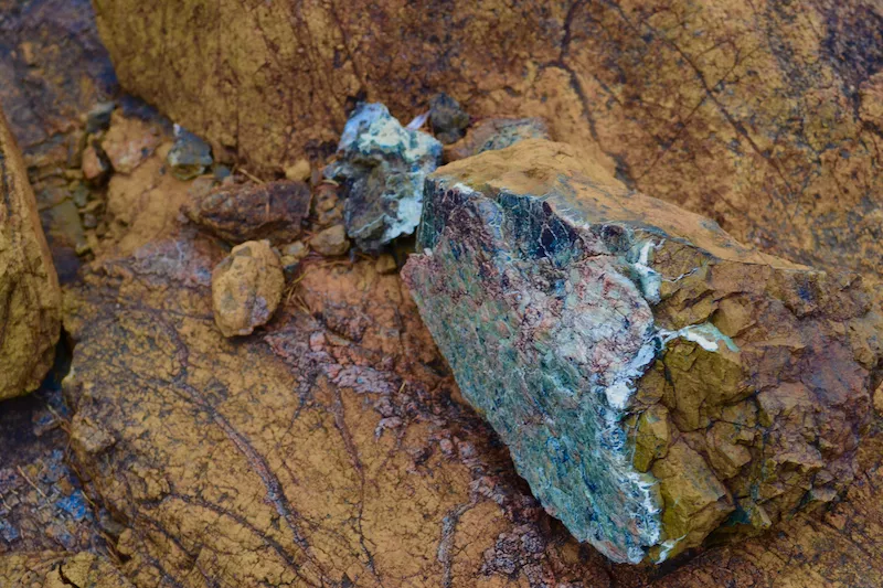 Peridotite with green serpentinite minerals.
 Hiking the Tablelands Trail in Gros Morne National Park (GMNP).
Next, take Route 431 to the community of Trout River, where you can walk a portion of the Trout River Pond Trail. This goes over a stunning, glacially carved valley, which would have been an old fjord, and is the divide between the peridotite rock and the Gaboriau rock across the pond.
There are accommodations in Trout River, including a campground and some cabins that do breakfast. It is a lovely, quiet little town to stay in, with a restaurant right on the ocean with the possibility of seeing whales. After dinner, I recommend taking the boardwalk trail out the point to watch the sunset over the ocean. It’s spectacular.
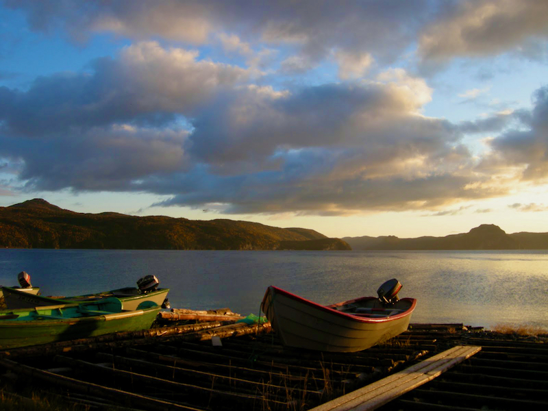
 Sunset at Trout River, a small rural fishing village.
Day Two
Next day, I recommend heading back to Woody Point to drive around Bonne Bay. Along the way I recommend a stop at South East Falls. This is just a small little trail to take in a big, gorgeous waterfall while you stretch your legs.
Then, head down into Norris Point and stop for a visit of the Bonne Bay Marine Station. Here you can get a better understanding the marine area and the significance of Bonne Bay, the fjords that are here, and the subarctic species that live in the area. Grab a coffee in town and head to the Norris Point trail head for a little trail to take in this scenic, historic, beautiful town in the fjord you just learned all about.
Then you would travel a little bit further north and perhaps take in the Green Gardens Trail. It’s a coastal hike along rock layers with a really significant geological formation where you can see the fossilized remains of the explosion of life events that happened on our planet millions of years ago.
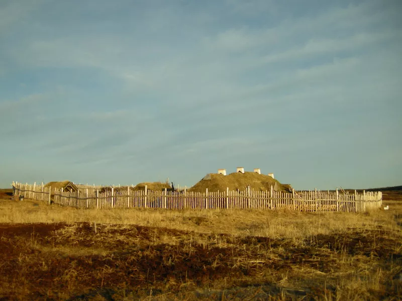 L’Anse aux Meadows is an archaeological site of a Norse settlement dating about 1,000 years ago.
Day Three
Then I would recommend a visit and stay in Cow Head. This little town has an excellent trail network out on their peninsula there. It’s worth a stop before driving further north.
I recommend a stop at the Thrombolites walking trail, and then hopping back in the car and heading up to L’Anse aux Meadows.
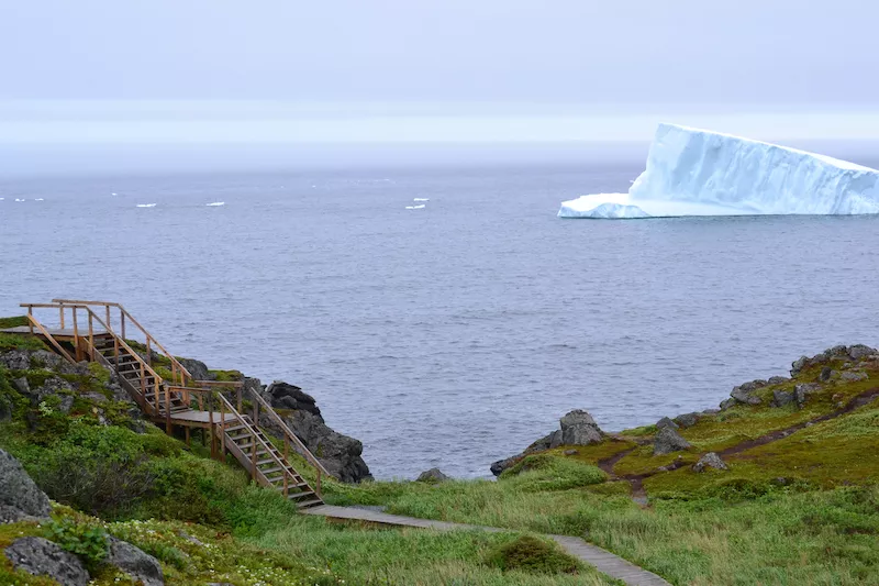 Icebergs seen from town of St. Anthony.
Day Four
L’Anse aux Meadows is a Vikings historical site in Newfoundland, and it has a lovely, coastal walking trail. Here is where you’ll start to see icebergs. For iceberg sightings, this is an itinerary you would do in May, June, and maybe into July. As the water warms up, naturally, the icebergs melt.
In July, though, whales, puffins, and other wildlife are there for the summer. There are lovely cabins in L’Anse aux Meadows, and a fabulous restaurant. It’s a nice place to stay.
Day Five
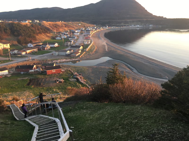
To finish the peninsula loop, you’ll head to St. Anthony. I recommend hiking the fishing point trail and carrying on to the little tiny community of Conche. This is over a gravel road into what was a very isolated community. There’s an extremely lovely network of trails out there. Rural Conche is a very authentic, Newfoundland fishing community where fishermen live in clapboard houses. There’s a museum here, the French Shore Interpretation Centre, with a really beautiful tapestry display.
From here, you’ll drive back around the loop, back to the 430, and I recommend a visit and stay in Port au Choix. This is another historical site with some amenities, including lodging and restaurants. Head to the Point Riche Lighthouse for a nice view of the shoreline. You can also enjoy fossil hunting or watch the sunset from the beach. I highly recommend this stop for families.
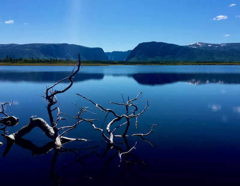 View of Western Brook Pond, a fjord or lake located in Gros Morne National Park.
Day Six
This day is for the return drive down to Gros Morne National Park and walk into Western Brook Pond. Here you can take a 2-hour boat tour into the fjord, then head back to Deer Lake. If time allows, heading back to the national park to explore more trails is always nice.
What’s a great itinerary for experienced hikers exploring the West Coast of Newfoundland?
I think it depends. If you’re looking for ideas, I would be happy to put together an itinerary for you to research and book on your own. I’m not a travel agent, but I’d be happy to point you in the right direction with suggestions for what to do and where to stay. I know many of the local business owners personally and can facilitate an introduction. Please feel free to get in touch through my website, Outdoors and On the Go.
If you’re looking to join an existing trip, such as a multi-day hike such as the Long Range Traverse, I recommend reaching out to a local adventure travel company. Gros Morne Adventures and Out East Adventures run experiences for advanced hikers, and I will say, the Out East Adventures company has the only permit access to Western Brook Pond, which is kind of iconic for Newfoundland tourism because of the spectacular views of the fjord there. People love taking that photo.
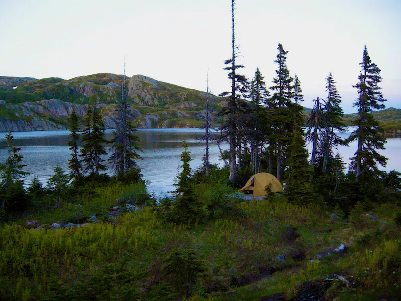 Tent on the Long Range Traverse, which is an unmarked and rugged backcountry route.
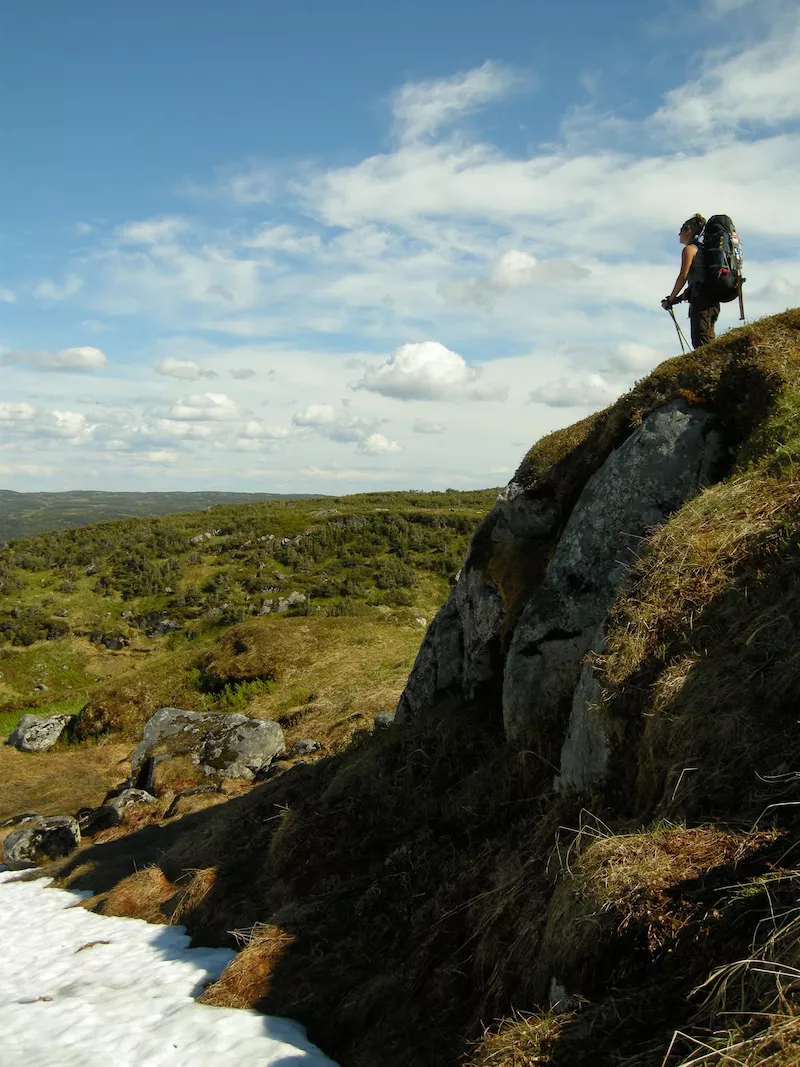 Hiker on the Long Range Traverse.
 Hiker on Long Range Traverse route in Gros Morne National Park.
Newfoundland or Labrador: Should I visit both?
There is plenty of hiking and backpacking in Newfoundland. I think Labrador naturally comes up when people are researching visits to Newfoundland because it is part of the province.
Depending on your interests, you might visit Labrador to explore the Torngat Mountains. They’re much bigger mountains than you can find on the island of Newfoundland. Labrador is crazy remote and stunningly beautiful. However, due to its remoteness, access is challenging and expensive, often by helicopter or boat, only. There is a scientific research station with a base camp in the Torngats that will invite groups to visit, but, again, it’s quite pricey. We’re talking $8,000-$10,000 per person to venture out there.
There’s not a lot of developed hiking in Labrador except for along the East Coast, and the interior is extremely barren. You’ll have to be prepared to be entirely self-supported, from getting there, getting around and feeding yourself, and getting out. There are virtually no people, and those who do live there are primarily along the coast and have adapted to the conditions and terrain. They primarily get around on four-wheelers, snowmobiles or by boat.
 Dory Boats in the town of Cox’s Cove, Newfoundland.
What do I need to know about getting around in Newfoundland?
Newfoundland has seven regions, and they mostly give context as to where things are located. The island is much bigger than people think it is. For instance, to drive from the town of Corner Brook on the west side of the island across to the capital, St. John’s, on the East Coast, it can take anywhere from 8 to 10 hours or even longer, depending on the weather.
It’s important to note that a lot of the roads in the rural areas are in poor condition (many, many potholes) because it’s expensive to maintain them. Another thing drivers must contend with is fog. In short, you’re not zooming around; things take a long time to get to. It’s not realistic to expect to see the entire island and enjoy a nice, authentic experience in a short period of time because of the time you’ll spend driving to get to the sights.
Fall colors in Southern Newfoundland.
What’s the best time of year to hike in Newfoundland?
Fortunately, Newfoundland has a long hiking season that starts in May and goes right through to the end of October.
May, June, and maybe July you’ll see icebergs.
June, July, August, and sometimes September you’ll see whales.
If you’re looking to avoid black flies and mosquitoes, it’s best to visit and hike August through October.
When you’re looking for access to amenities, such as restaurants, coffee shops, and boat tours, you’ll want to visit between the middle of June and the middle of September.
For spectacular views of fall foliage, you’ll want to visit the middle of September through the middle of October. Foliage season is fairly short lived in Newfoundland, but absolutely stunning and you can’t beat the warm days and cool nights. It does get dark right around 6:00pm, though.
For folks that want to do the bigger and longer multi day hikes, May, June, and July are really your best window for doing that, especially for those really long days.
How many hiking trails are in Newfoundland?
The number that we put in the book was 157, and those were selected based on certain criteria, including signage, parking, and a somewhat-maintained trail to follow, whether by tape, signs, or blazes. They’re either maintained by the nearby community or a local trail organization.
Really, the number of informal trails throughout Newfoundland is unbelievable. Although, many of these informal trails are used for hunting. People who visit in the fall need to be really aware of hunting season. It runs September, around Labor Day, right through Christmas. It is essential to come prepared for this. You must be wearing orange, you need to have your dog on a leash, and you need to stay on the trail.
Are the trails well marked?
Trails are marked well if they are the East Coast Trail or they’re within Gros Morne National Park. Every other trail is subject to the local community or organization that’s maintaining it.
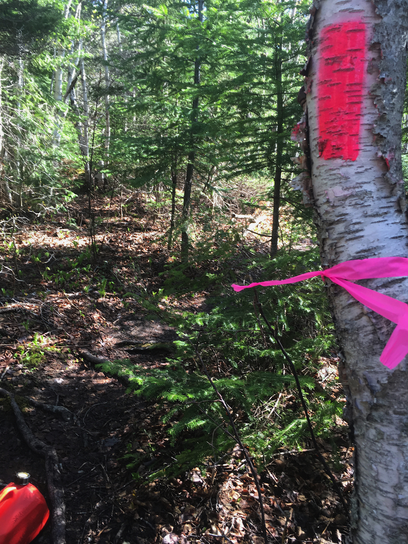 Paint and flagging tape used on IAT (International Appalachian Trail) near Corner Brook.
There’s a really cute little network of trails on the West Coast in a little town called Lark Harbour. The Outer Bay of Islands committee maintains this network of coastal and mountain trails. They’ve partnered with the International Appalachian Trail to help make the little marks you see along the Appalachian Trail – those little metal markers that get nailed to trees. They also use flagging tape and spray paint to mark the way.
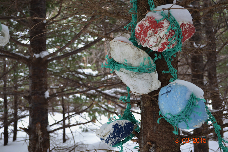 Outer Bay of Islands Enhancement Committee (OBIEC) uses old buoys to mark trails.
On one of their trails, called Cedar Cove, near where the fishermen mark their nets with buoys, they’ve actually marked the trail by hanging those bits that wash up on the beach. So, you’ll see everything from flagging tape, to just the footpath, to these buoys hanging in trees, to spray paint, to metal stakes.
There’s huge variety in the way that trails are marked here. People find it extremely challenging in winter because despite being properly marked, a lot of people get lost because they don’t know how to navigate properly.
What is the best way to get help if I get hurt or lost?
Rule number one is to always tell somebody where you’re going. So, whether that is calling your mother in Ontario, and telling her, “I’m going to go for a hike today. Here’s where I’m going, I’m going to text you when I get back, and here’s the number you should call if I don’t show up,” is important.
If you’re staying at a bed and breakfast here in Newfoundland, you can always tell the owner. Locals know that it’s remote and hard to get cell service, so they’re often happy to call their friend down the road to go in after you on a quad if you haven’t come back by dark.
If you are feeling like neither of those options are good enough, then you should definitely bring a GPS messaging device. It still helps to tell someone where you’re going to give context to where you are and the type of help you need. If that person isn’t in Newfoundland, they may not know to access the local search rescue.
These devices have limitations, though. It can be really cloudy and overcast in Newfoundland, and I’ve personally experienced my GPS device having poor signal and not sending a message out because of the cloud cover.
Another tool that actually works pretty well for hiking in coastal areas, the East Coast Trail for example, would be a marine radio. These devices are used by fishermen and kayakers. Sometimes you can rent them from local gear shops.
The West Coast comes with some added challenges in that marine radios don’t work well in mountainous backcountry. When I guided, I’d carry a satellite phone and a list of key contacts, the local search and rescue, and the park numbers. I brief clients on the phone and list of contacts in the event that I was unable to use it. It was for emergency use only.
What are some of Newfoundland’s tourist hot spots on the East Coast?
- The East Coast Trail. The total trail length is 336km/209mi and it goes through multiple communities. You can easily hike it in sections.
- Signal Hill. A walk from downtown St. John’s that includes steps up a slope that ends with a view of the ocean. There’s a historic building up there, and the entire area gets heavy local use. You’ll see lots of walkers and runners on that trail.
- The Spout. The Spout is a segment on the East Coast Trail. People like it because waves come crashing into this cave and shoot up through a hole in the rock. It’s a fairly hefty hike at a total of 23km/14mi. However, most people only do the section to the Spout and back out.
Final thoughts?
I just can’t stress enough the distance between places and the need to have a car, and also coming to Newfoundland ready to be self-sufficient. In particular with hiking, just put everything in your backpack to take with you. Be ready to have an emergency in the wilderness. Because it is such a remote place, getting help is not easy.
However, with that remoteness comes a deep wilderness experience that, quite frankly, you don’t get in a lot of places because Newfoundland is still, primarily, Crown land. As a result, that European concept of shared passage on common land is still very alive and well where this huge landmass is like basically a wilderness free for all to enjoy. This doesn’t exist in many other parts of Canada or the U.S.
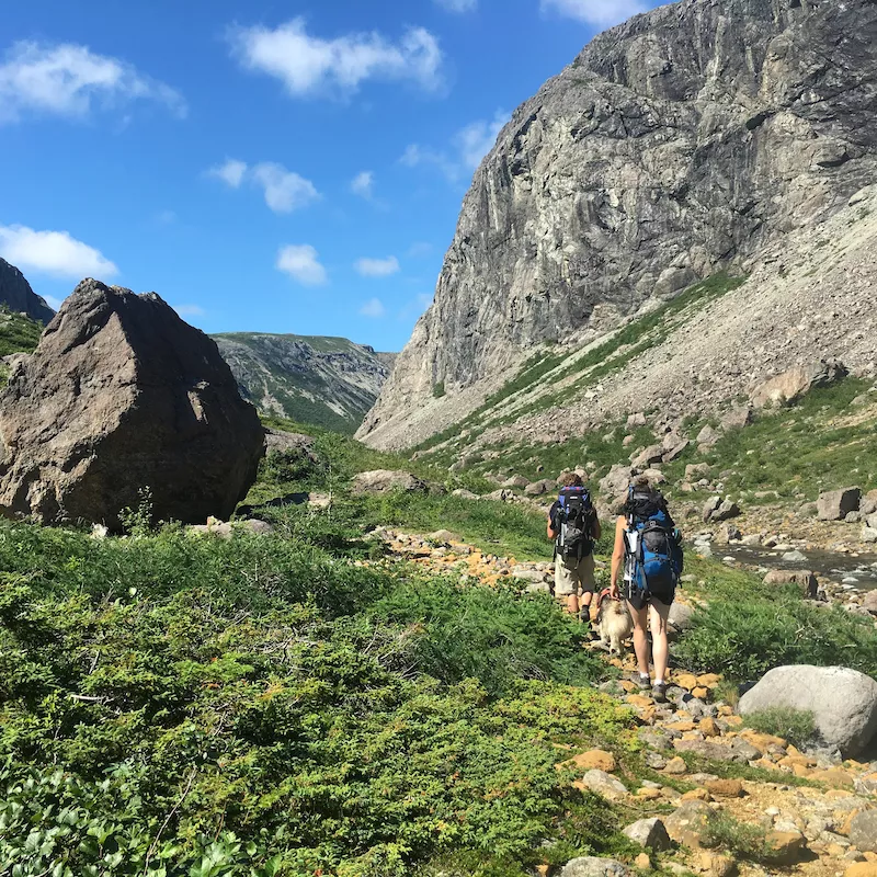 Two hikers hiking into the Blow Me Down Mountains.
You can snowmobile, you can hike, you can four-wheel. Newfoundland is a big playground for outdoorsy people. With that fun comes the responsibility of being prepared to take care of yourself, but also to take care of the land and following Leave No Trace principles.
Bring your best practices from those protected spaces you visit. Please don’t get lazy just because you’re coming to a wild place. Newfoundland is a remote island with waste processing and local education issues with regards to waste. So, pack it in, pack it out, and if you can, take it home with you. That would actually be really helpful.
Carola Jain
Newfoundland looks like a great place to take a hike and I’m happy to see just how in-depth you got into this, providing tips for those that may be looking to go hiking there in the future. Wonderful insight here!