Hiking Washington State: From Puget Sound to Volcanic Peaks
Despite rainy weather the region is known for, hikes in Washington are alluring. The appeal of Washington is inarguable because the state is rife with lush greenery, lakes, and waterfalls. Hikers looking to tackle trails in the Pacific Northwest make Washington hard to resist.
It’s important to note that while the trails in Washington are well-groomed, challenges include elevation gain, long hikes to remote locations, challenging water crossings, and avalanche conditions. As you research your trip to explore hikes in Washington, check out Fit For Trips’ custom training programs or schedule a complimentary fitness consultation with Marcus Shapiro. Preparing your body for the rigors of the Pacific Northwest will help you make the best of your self-powered adventure.
From self-powered to high-powered, meet Craig Romano. With 30,000 miles of Washington hiking and backpacking under his belt, Craig has much to offer on the topic. From growing up in rural New Hampshire, to being a ski bum in Vermont, and traveling the world extensively, this outdoor writer and award-winning guidebook author made Washington his home. Join us for a virtual tour of spots to enjoy nature in Washington, from easy-access urban trails, to day hikes, to backpacking trips. Now, we’ll hand it over to Craig.
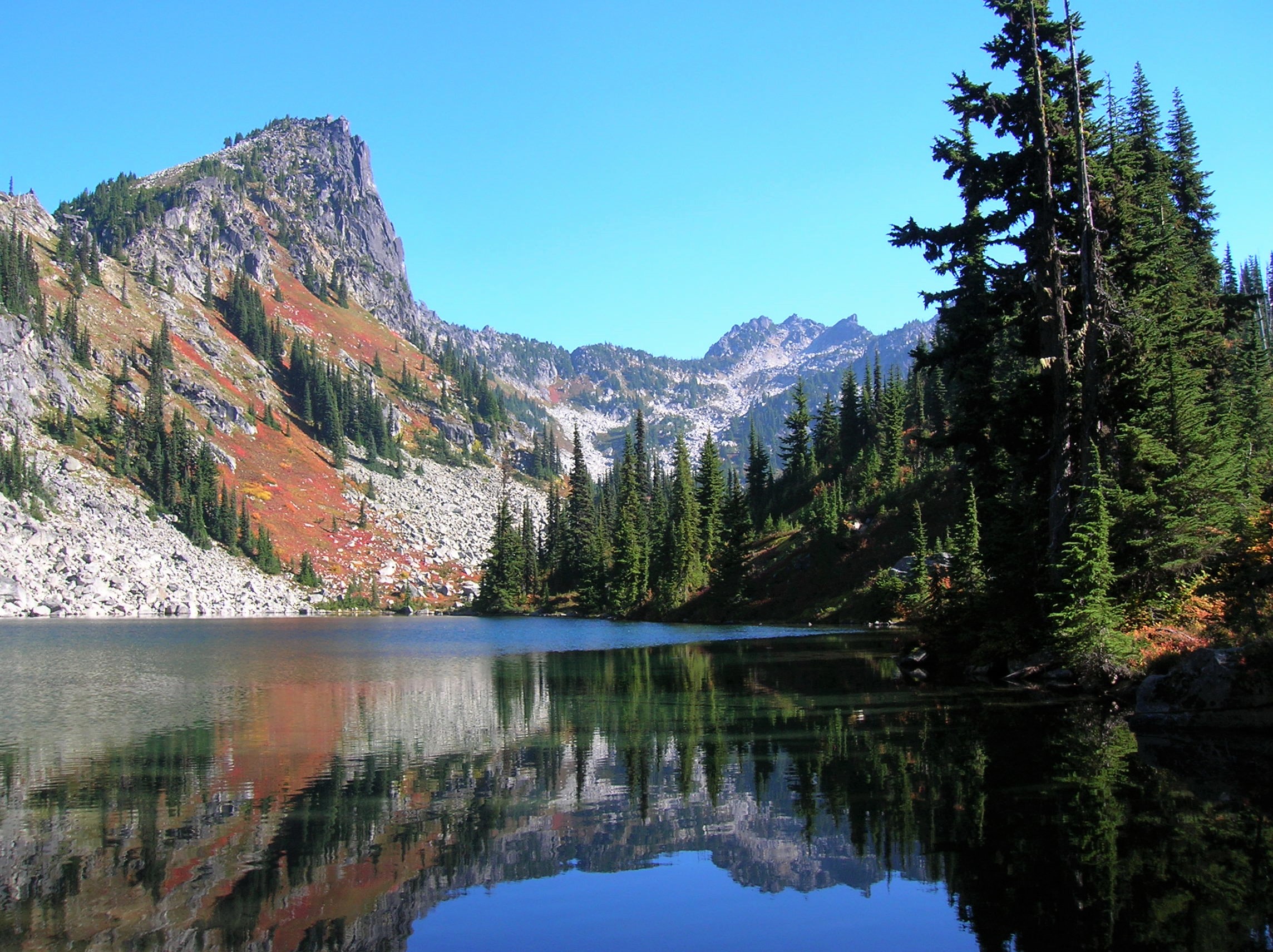
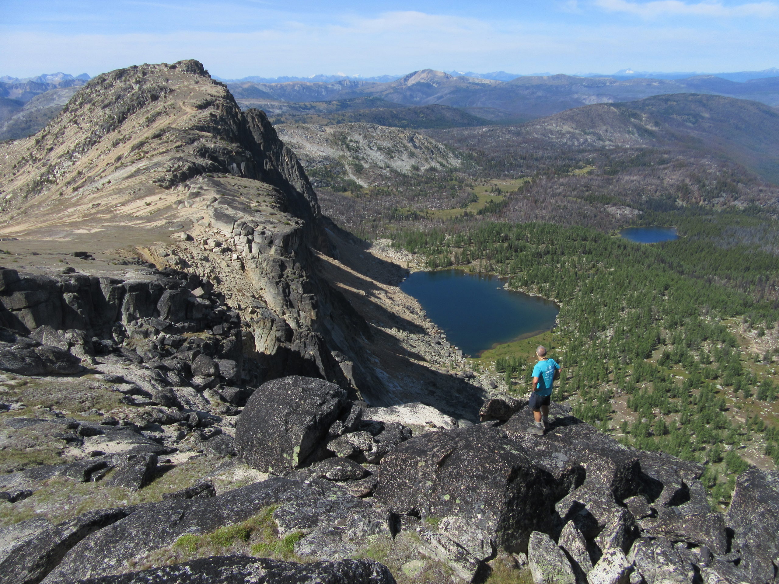 Craig Romano overlooking the Cathedral Lakes in Pasayten Wilderness
Hiking with a Sense of Discovery
I’ve always been a wanderer. I love fun, I love traveling, and I always encourage people to use that sense of discovery. It would have been amazing to have been the first Italian-American on the Lewis and Clark expedition.
I have hiked thousands of trails. People often ask me what my favorite trail is. This sounds like a cheesy response, but it’s not and I actually mean it: My favorite trail is the trail I’m on right now. I could never pick just one trail or recommend a top-10 list because picking trails is so subjective.
I got my first degree back East, so I learned in the northern hardwoods there, and I like big trees. And actually, when I was studying history at the University of Washington, I took electives in the forestry department because I wanted to learn some of the differences. I took an old growth forest class and it was incredible. A lot of people don’t like hiking for 10 miles in forests and never getting a view. I like that kind of stuff.
So, I appreciate those amazing forests that I’m hiking through, knowing about their life systems and their intricacies, and the interdependence and everything. A lot of hikers don’t see that. If you take the time to learn about the forests and are hiking with that sense of discovery, you’re going to see things you never saw before.
It’s interesting to apply that mindset to the fires that have become common out west, too. When people hear about the fires, they’re thinking it’s the end of the world. What they don’t realize is it’s part of the cycle. It’s amazing how resilient nature is.
A classic example is Mount St. Helens. So, Mount St. Helens blew in 1980, and people were saying, “The landscape is devastated. It’s never going to come back.” How wrong can you be? If you go today, it is unbelievable how much has changed. I first hiked there in 1989, and it looked like someone dropped a bomb on the landscape. It was all gray and pumice, and there were very few plants. Now, more than three decades later, there are 40-foot-tall trees, blooming flowers, and elk all over the place. Nature is coming back. It is amazing. Just understanding the cycles of the life of the tree and the forest and the effects that wind, fire, and insects and everything else have, and also the interdependency of wildlife, you’re going to have a very different appreciation of being out there.
Read our feature post for more information about hiking and backpacking Mount St. Helens.
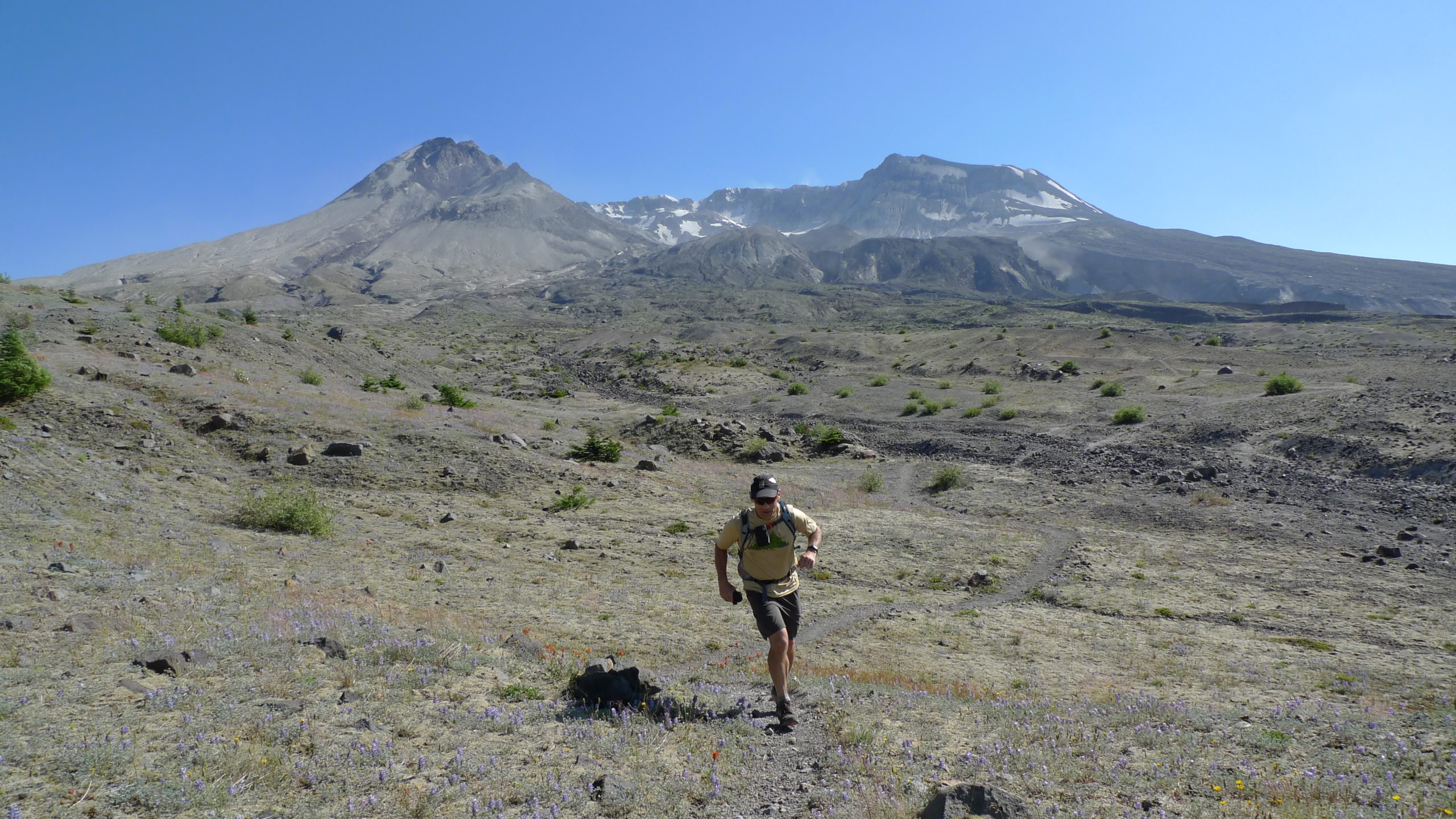 Craig Romano trail running the Loowit Trail in Mount St. Helens National Volcanic Monument
East Coast vs West Coast Hikes in Washington
I grew up in New England, but I’ve lived in the Northwest for many years, and people always ask me which area I like better. They’re two different places with two different ball games, so they can’t be compared and I love them both equally. I look at everything for what it is and the beauty that it represents. If you have that attitude, you will never be disappointed.
The North Cascades, where I primarily hike, are the youngest mountains in the country, and they are incredibly rugged and rough. The mountains out west are more dramatic. On the other hand, New Hampshire is part of the Appalachians. The peaks aren’t as high or rugged in the East as they are in Washington.
The Appalachians are some of the oldest mountains in the country. You might think that because the mountains in the East aren’t as high, that the hiking is going to be easier there. That’s not the case, especially in the Northeast. There’s no such thing as switchbacks in the Northeast. You’re hiking on bedrock, and there’s a lot of scrambling. If you grew up hiking in the East, I think you might find some of the hiking out west, on well groomed trails, will be a lot easier.
A lot of the peaks in Washington you have these nice, well-developed switchback trails. The hiking and trail running is so much easier. So, don’t get this idea that just because the peaks in the West are higher and more rugged that it’s harder. Although, there certainly is a lot of hard terrain out here, as well.
Ecologically, the East and West are two different ball games. So, the in eastern mountains it’s the hardwood forests. The western, it’s evergreen. I find there’s more biomass in the Northwest, meaning the old-growth forest has incredible amounts of biomass, but there is more biodiversity in the East, especially in an area like the Smoky Mountains. But even as you get farther into New England, there’s just a lot more biodiversity. All that said, I don’t think one’s better than the other.
A lot of people try to compare everything to the superlatives. For example, I’ve seen Mt. Rainier, and it’s an amazing place. And so, nothing else can be Mt. Rainier. But that doesn’t mean that something else can’t also be that beautiful. I’ve hiked in Mississippi’s Bald Cypress swamps, and I thought they were amazing. Sure, it’s not Mount Rainier, but you’re not going to see alligators and Bald Cypress in Washington. It’s an entirely different thing.
I encourage people to be open minded and to really enjoy the landscape, the diversity of the land and the wildlife, and how it interrelates.
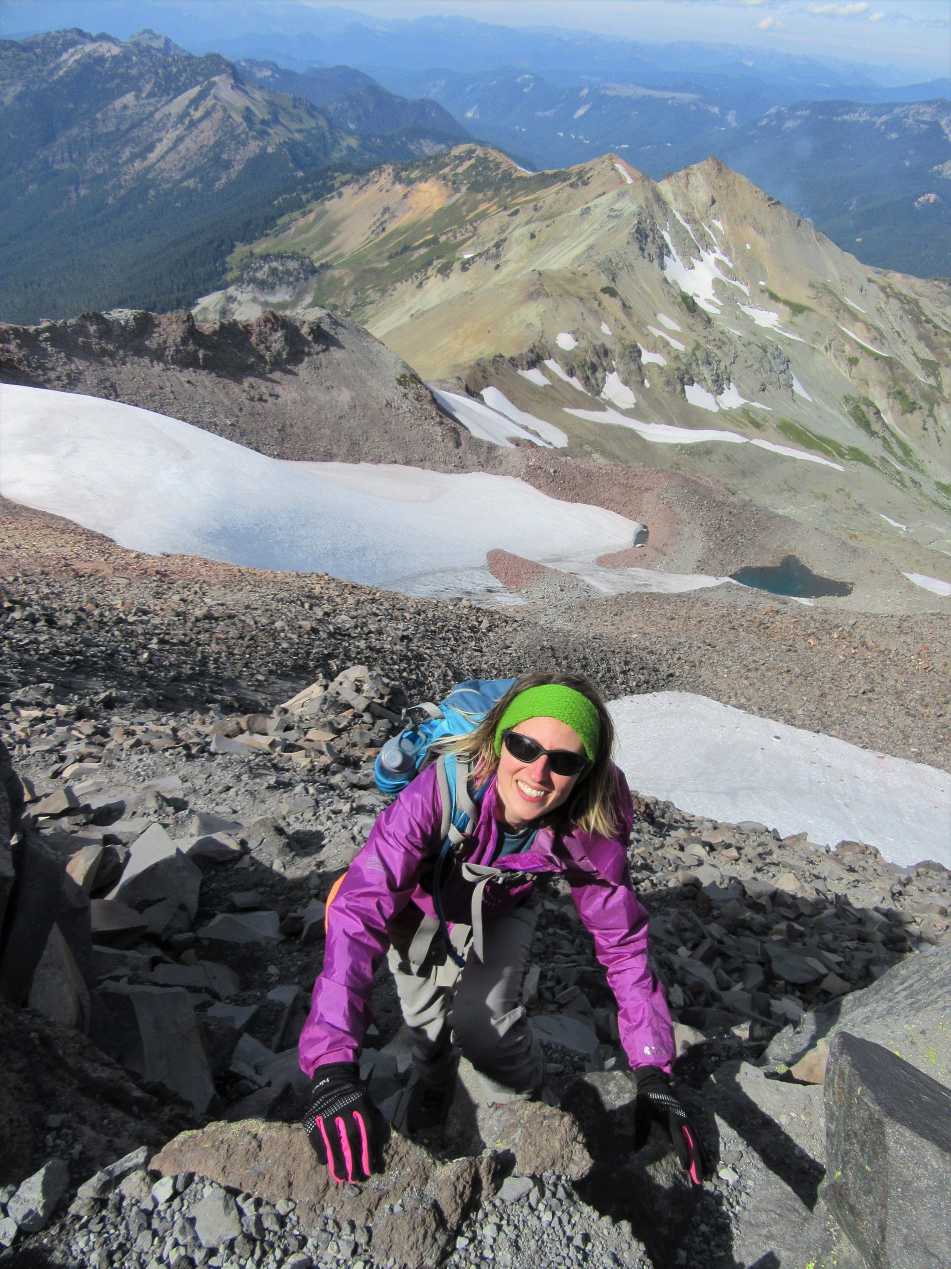 Scrambling Old Snowy in Goat Rocks Wilderness
Hiking Washington’s Diverse Regions
People often ask me where they should go hiking in Washington state. I don’t know anything about you, so honestly, my recommendation would be an arbitrary shot in the dark.
What do you like to see when you hike? What kind of terrain do you want to walk on? What’s your physical-fitness level? Finding a hike should cater to you.
I think the beauty of guidebooks is that they help you make your own discoveries. So many people are passively being fed information on the internet, see a pretty place, and want to go be there and take that picture. Whereas, when you pick up a book and read it, you’re doing the research and making your own discoveries. It’s leaving a lot more to the imagination.
 Craig Romano trail running in Goat Rocks Wilderness
Olympic Peninsula
The Olympic Peninsula is a huge area. It’s northwestern part of the state, and it’s very lightly populated. The Olympic Mountains were one of the last, major mountain ranges in the lower 48 to be explored by people. A lot of native population wouldn’t go into the area. It’s one of these places that has always been a mystery.
Even though Olympic National Park is one of the most visited national parks in the country, most of the visitors are just going along the periphery. To really cover a lot of ground in Olympic National Park, you have to backpack for days into the heart of it. Nearly every time I’ve hiked into the core of the Olympics, I’ve seen bear and elk. There’s just so much wildlife in this park.
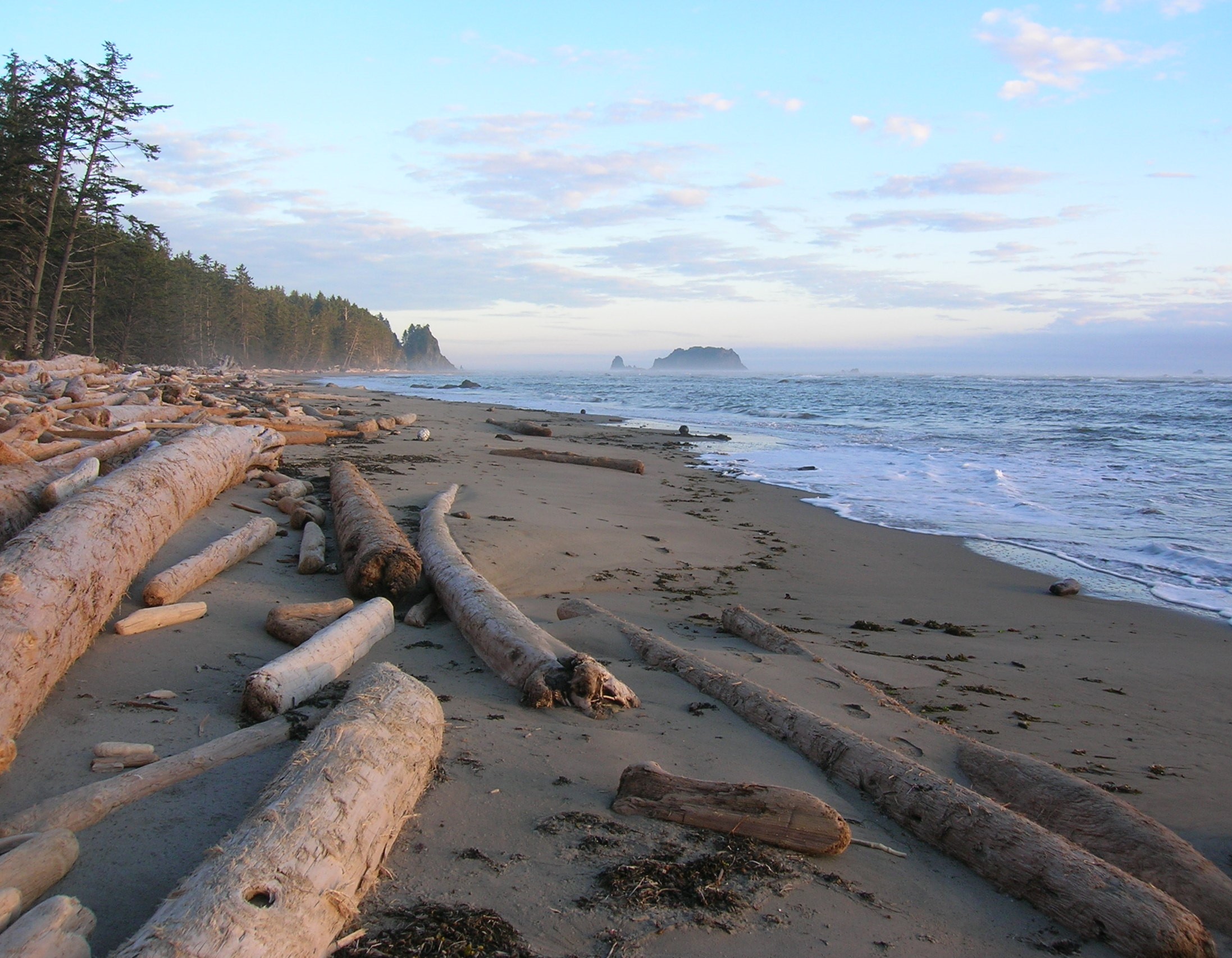 Kayostla Beach Olympic Coast
But again, as I mentioned earlier, what makes the Olympics even more unique is that there are three different, distinct ecosystems on that peninsula. You’ve got the alpine area, which is a jagged mountain range. Mount Olympus is not even 8,000 feet, and it has one of the largest glacial systems in the lower 48.
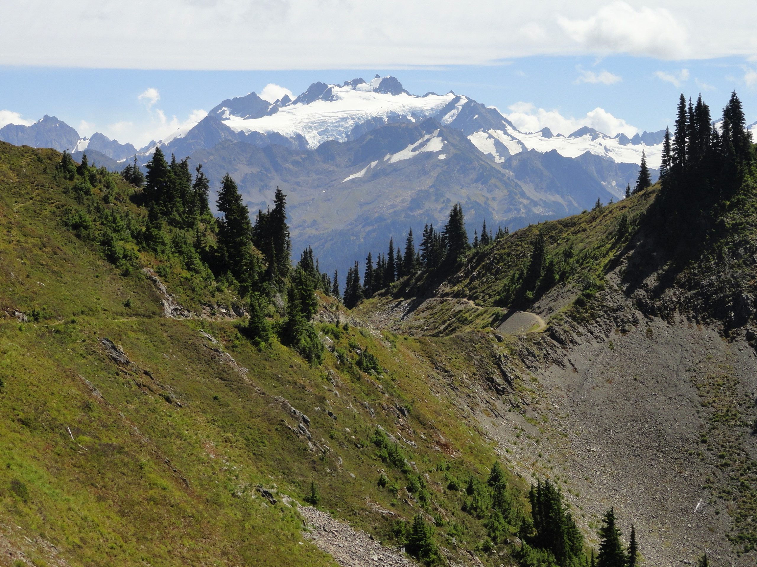 Mount Olympus rising above High Divide Olympic National Park
Because of the of all the rainfall on the western side of the peninsula, you have temperate rainforest. Temperate rainforest is only found here, in southern British Columbia, southern Chile and New Zealand. Here is where I’ve seen some of the largest trees outside the coastal California Redwoods.
Washington also has a wilderness coast. And again, there aren’t too many places in the lower 48 that are away from roads and development. Washington has around 50 miles of wilderness coast in Olympic National Park. There you can backpack along the coast. There are no roads, so you’re not going to see very many people. Areas of the coast can be tough to hike—almost as tough as hiking mountains.
There’s one stretch that is just four miles, but you’re just walking on barnacle-encrusted rocks. You have to wait for the tide to get to certain areas. It’s going to take you an hour per mile to get through it. You can only get around certain headlands when the tides are low. So, it can be really challenging hiking on Washington’s coast.
Day Hiking: Olympic Peninsula / Amazon: check price
North Cascades
The North Cascades are really just the most inspiring mountains, and I feel confident saying that having hiked a good part of the country. I live very close to North Cascades National Park, in the northwest corner of the state. There’s nothing like it. The mountains in this area start at sea level and rise 8,000-9,000 feet. Plus, they’re not these big, well-rounded peaks. They’re jagged precipices and crags, and they’re just forbidding-looking mountains.
 Male hiker approaching Sahalie Mountain in North Cascades National Park
There are some nice day hikes around Mount Baker, North Cascades Highway, Methow Valley, and Mountain Loop Highway. However, once you get into places like North Cascades National Park, there aren’t that many trails, because these aren’t mountains that you can just do easy day hikes in. In the past, trails were built for a purpose. They either went up to a fire lookout, an old mine, or something like that. They weren’t being built for recreation back in the day.
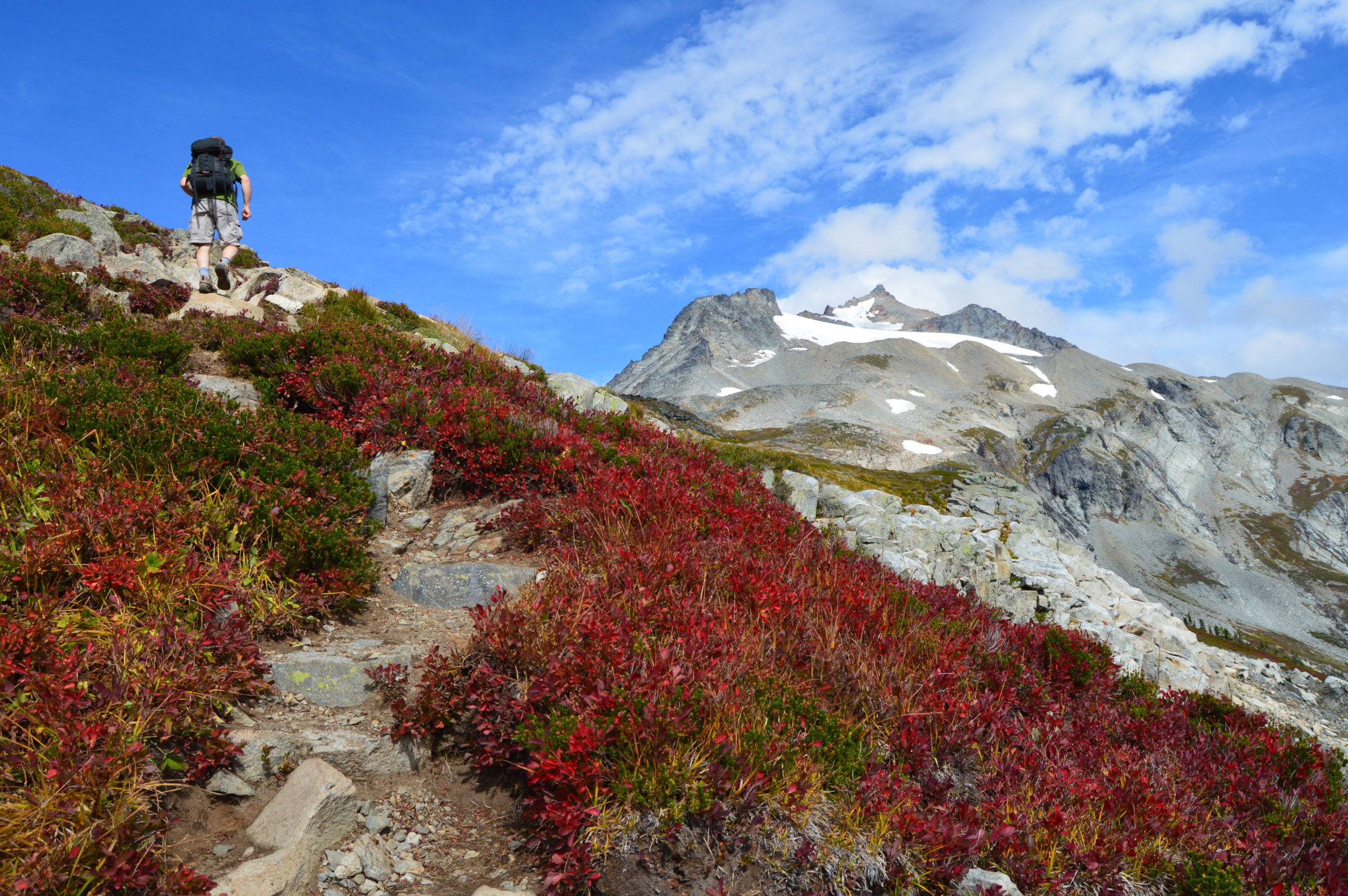
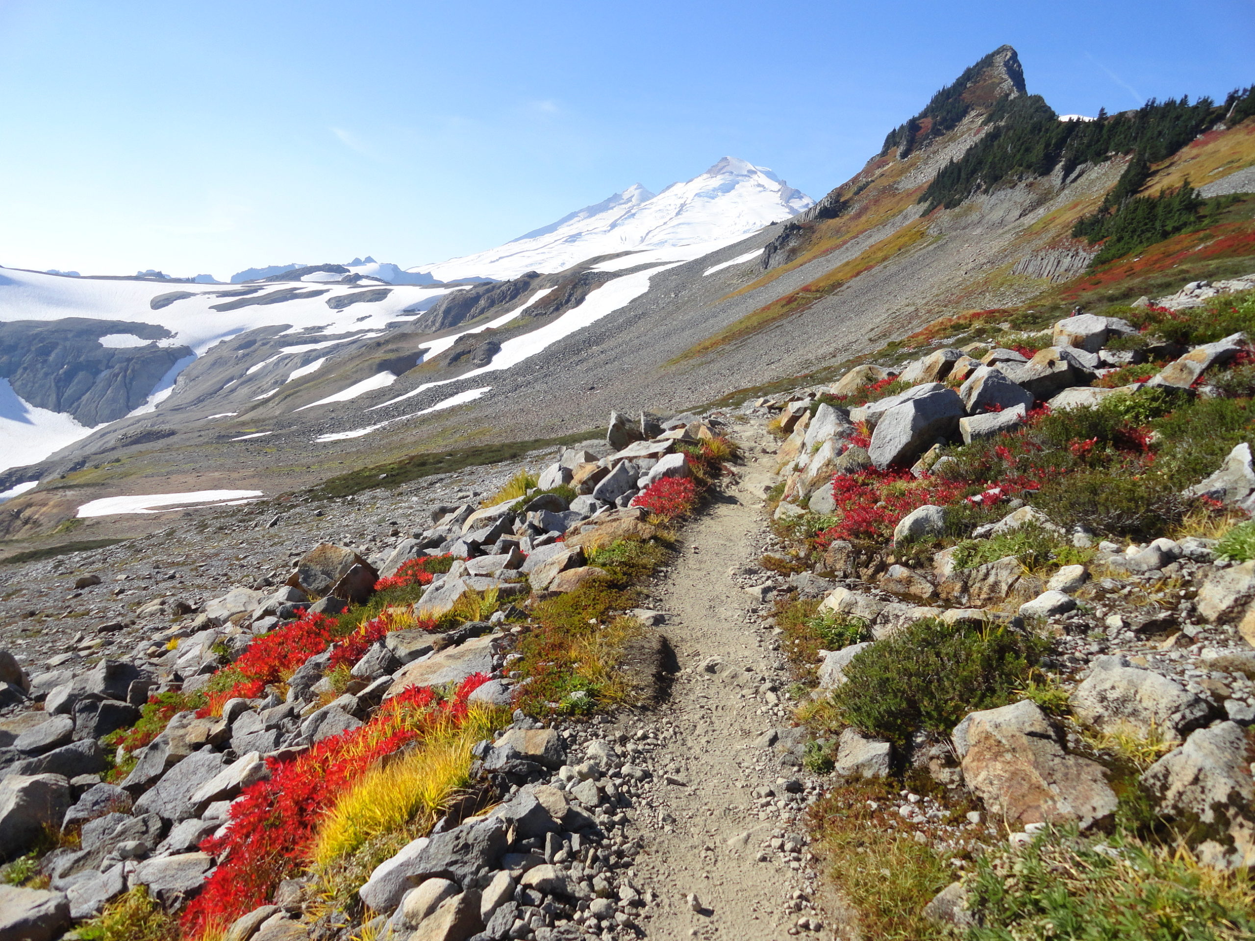
 Mount Shuksan rising over High Divide in Mount Baker Wilderness area
Because this was one of the last areas that was settled by non-native people, it’s one of the best wildernesses left in the lower 48. North Cascades National Park is more than 600,000 wilderness acres bordering the half-million-acre Glacier Peak Wilderness. There is also the Pasayten Wilderness, which is a half-million acres.
 Hikers overlooking Triad Lake near High Pass in Glacier Peak Wilderness
One important thing I should mention is that North Cascades National Park is not like other parks. You can’t really drive into it. There’s only one tiny access the road goes through, so it’s primarily accessed by hiking in. There’s a national recreation area abutting the park that folks think is the park. But North Cascades NP is truly a hiker’s wilderness park.
For about six months of the year, the North Cascades Highway, which is the state’s northern-most east-west highway, isn’t even open due to snow cover. So, you’ve got all of this contiguous wilderness that makes up the largest wilderness area in the lower 48. It is rugged, it’s remote, it’s one of the last places in the country that really feels like there haven’t been too many people there. Of course, people have been everywhere. Miners have worked in the North Cascades, and native people have hunted and worked trade routes. So, there’s a lot of fascinating history in this part of the state.
Day Hiking: North Cascades / Amazon: check price / REI: check price
Central Cascades
How I define the Central Cascades is pretty much north of I-90 and the Alpine Lakes Wilderness, but not quite into North Cascades National Park. This is an area that’s accessed by Highway 2, which is one of only a few east-west highways in the state. The mountains are definitely a big roadblock, so, getting into some of these areas is not easy.
 Hiker approaching Ladies Pass in Alpine Lakes Wilderness
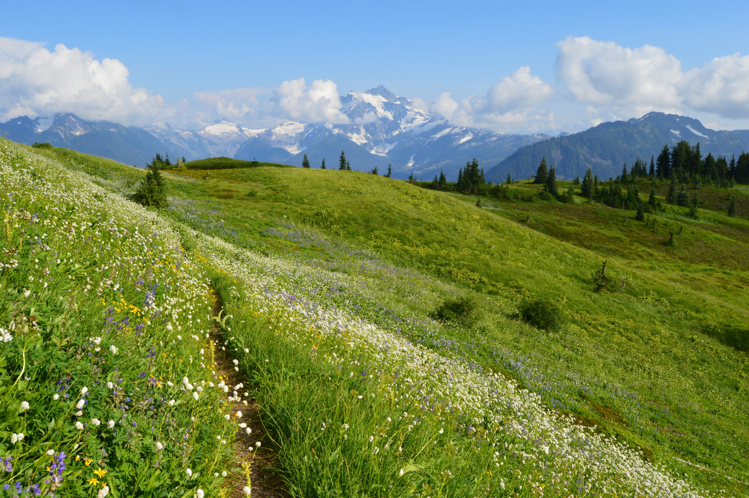
One of the defining features of the Central Cascades are the alpine meadows. There are miles and miles of these spectacular, alpine meadows. The stretch of the Pacific Crest Trail from Steven’s Path off Highway 2 into the Glacier Peak Wilderness is one of my most enjoyable places to explore. It’s pretty easy hiking for the Northwest because you’re on this well-graded trail that was built for horses.
 Hiker atop Johnson Peak in Glacier Peak Wilderness
As you’re trekking along ridges, you’re going across miles and miles of these stunning meadows that, come July, are a kaleidoscope of wildflower blossoms. In the fall, even though this area doesn’t get the foliage like the East does because the lack of hardwoods in the alpine areas, the color change is still beautiful. The blueberry bushes turn red, the Mountain Ash turn orange, and there’s lots of color in the avalanche zones and old burn zones.
Day Hiking: Central Cascades / Amazon: check price
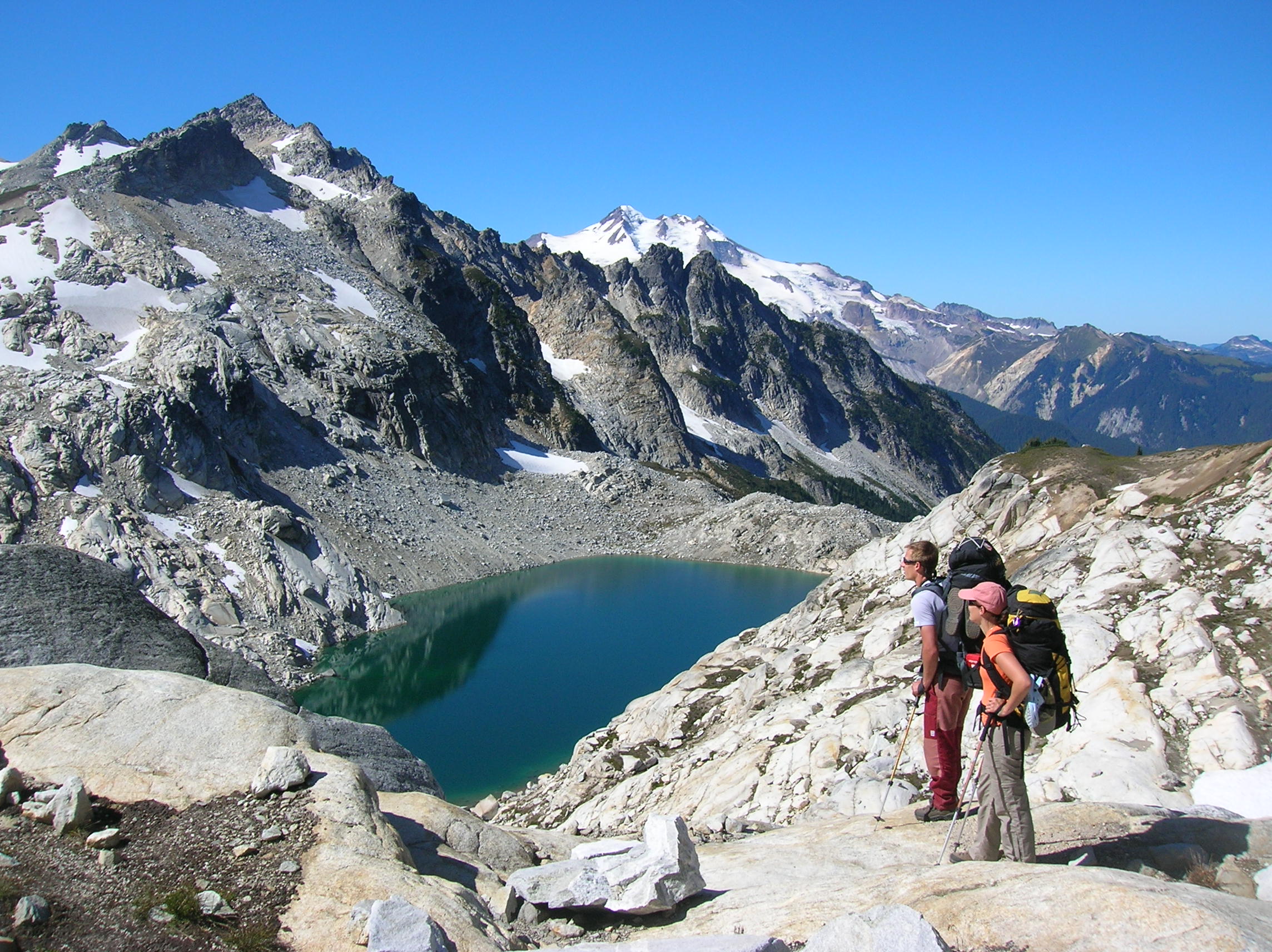
Alpine Lakes Wilderness
When you get into the central part of Washington’s Cascades, I’ve never seen so many alpine lakes anywhere in the country. Alpine Lakes Wilderness is one of the bigger lures for hikers visiting Washington. You’ll find some difference of the Cascades in Washington as opposed to the Cascades in Oregon and Northern California, because their ridges are longer and drier.
Alpine Lakes covers nearly 400,000 acres. It’s one of the most popular wilderness areas in the country and is a short drive from Seattle. This area is home to 700 named bodies of water ranging in size from ponds to very large lakes. Some are easily accessible, others are much farther in.
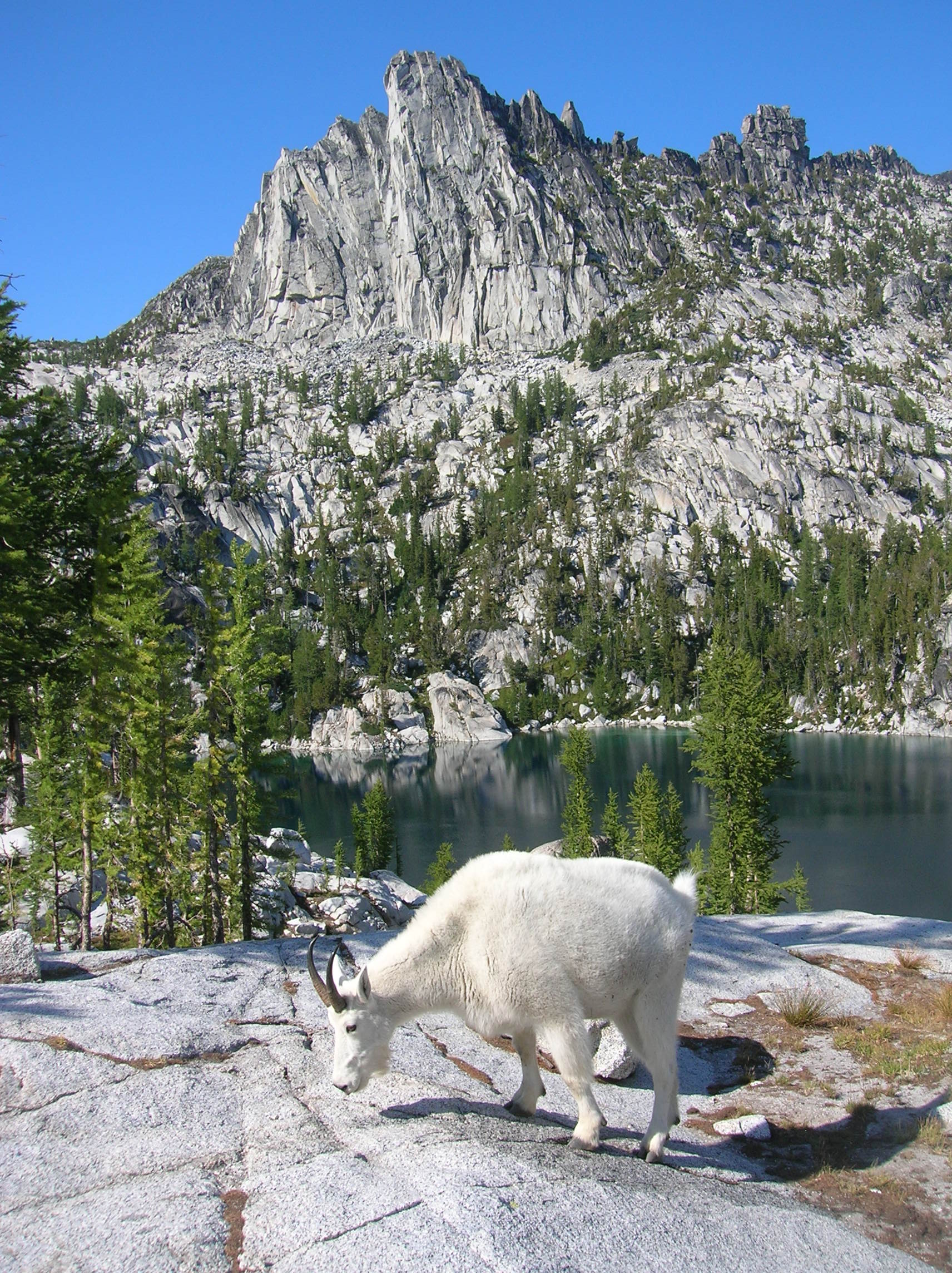 Mountain goat at Enchantment Lakes in Alpine Lakes Wilderness
The quality and coldness of the sparkling water in these beautiful lakes is a big draw for many people looking to go hiking in this area. Be aware that permits are required for day hiking and overnight trips within the reservation area and are available on a self-issue basis at trailheads. Always check the Forest Service website for updates on permitting, trail closures, and road closures.
South Cascades
So, basically, the South Cascade area is considered south of I-90, which is the major interstate that runs east to west and cuts the norther part of the state in half. The mountains in the South Cascades are not as rugged as mountains north of I-90. Here you’ll have longer ridges that look a lot like what you see in the Appalachians. The primary difference is that here, the forests are evergreen with very few hardwoods.
But what makes it more distinct is there are these huge volcanoes with regular activity. Here you’ve got Mount Rainier, which is the highest mountain in Washington and the highest mountain in the Cascades as well. Mount Rainier stands at 14,411 feet. It’s gigantic, and you can see it from nearly two-thirds of the state on a clear day.
Mount Adams, is the second-highest peak in the state at more 12,000 feet. And then Mount St. Helens, of course, which is one of the most famous volcanoes in America, is also in the South Cascades. In addition to these three, giant volcanoes, there are lots of ancient cinder cones and lava flows. A lot of volcanic activity really defines this region.
I don’t think about this as much, but I know people are into the whole Sasquatch mystery. I think there are more Sasquatch sightings in the South Cascades than anywhere else in the state.
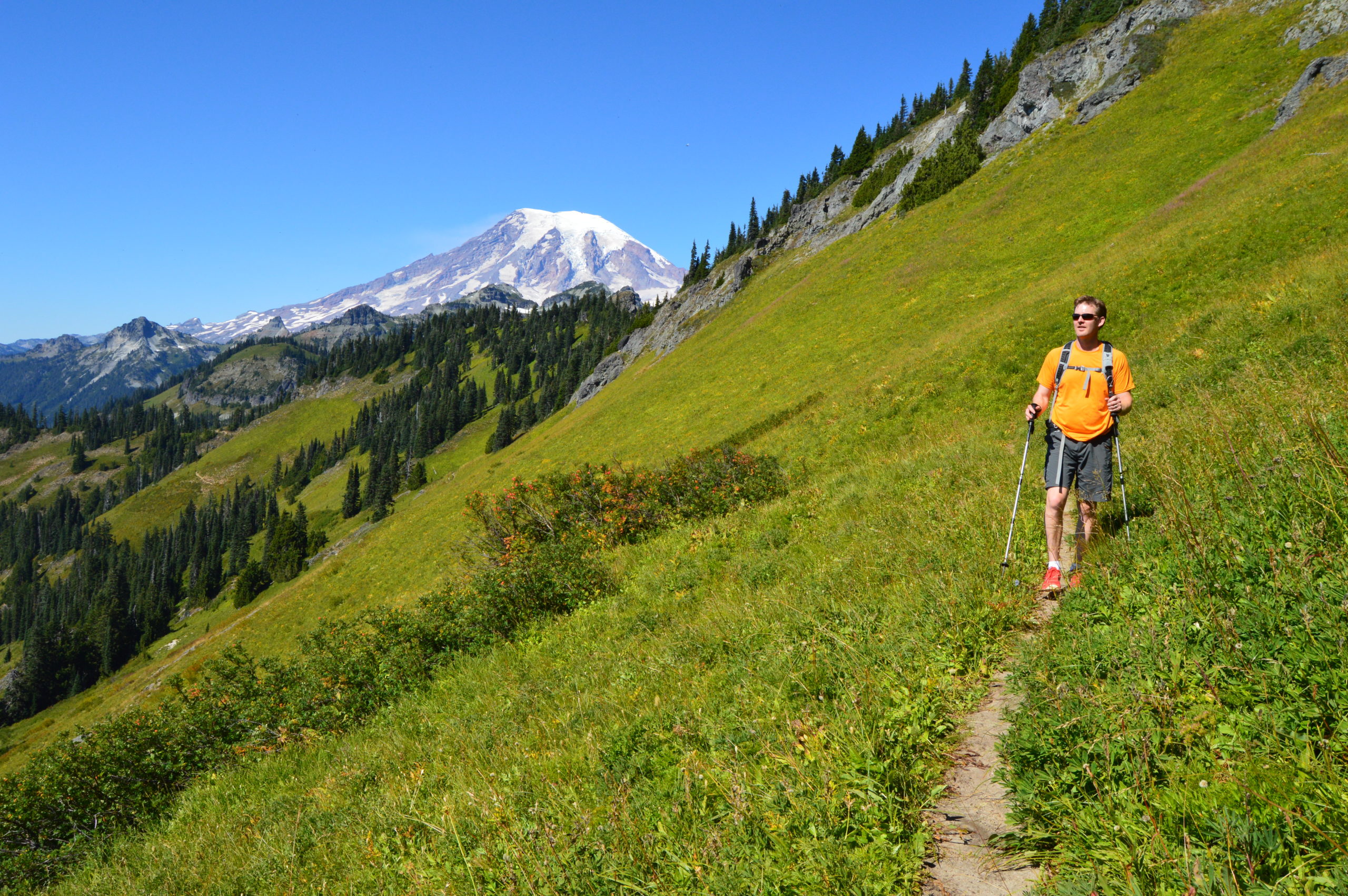
Mount Rainier
Mount Rainier National Park is an amazing park, and again, the peak itself is amazing. What makes Rainier so distinct is that it’s a stand-alone mountain. It’s just, it is so, so, so huge. You can see it from Puget Sound, which is impressive to be at sea level and looking at a mountain a hundred miles away.
Even though a lot of people love to visit Mount Rainier for climbing, the hiking there is amazing, too. The Wonderland Trail, a famous trail that is more than 100 years old, goes 93 miles around Mt. Rainier. It has become incredibly popular in the last few years. It’s hard to get permits for overnight trips, but there are lots of great day hikes near Mount Rainier.
Rainier has many different areas to explore that are accessible from the Wonderland Trail. The Many people are drawn to the alpine area for the glaciers. Rainier has an amazing glacier system, but also, the alpine meadows are amazing. Called parks, or parklands, these are open meadows with clusters of Alpine Fir and Mountain Hemlock. This my favorite zone of Rainier, and I think a lot of the people would say the same thing.
It’s not on the coast, but the northwest corner of Mount Rainier is wet enough to have its own rainforest systems, whereas the eastern side of the mountain is a lot drier. Just by hiking around the mountain, you’re going to see amazing diversity within 50 miles.
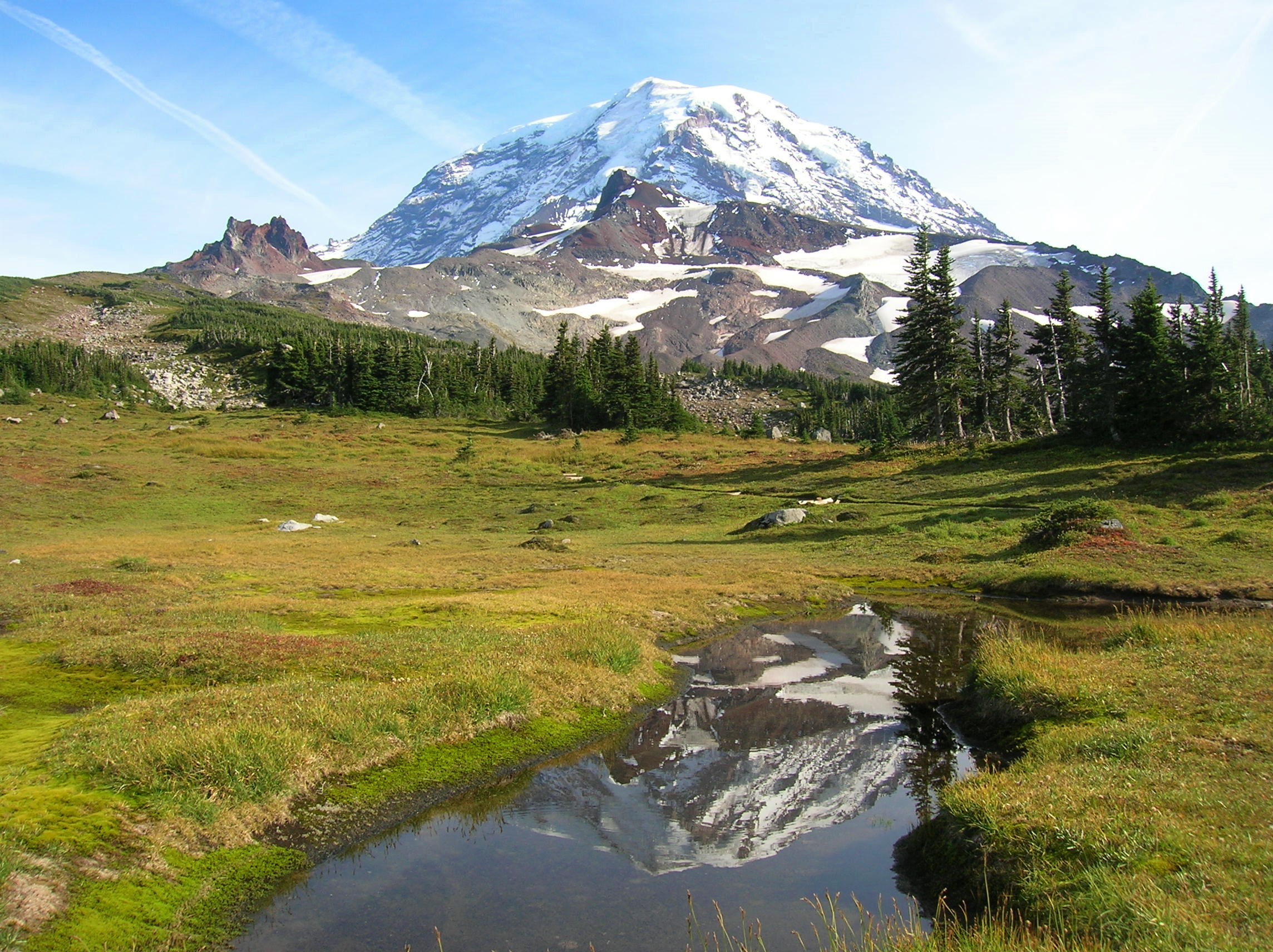 Spray Park in Mount Rainier National Park
The San Juans and Gulf Islands
I live 15 miles from the ferry to the San Juan Islands. It’s another one of my favorite areas. When I first visited the San Juans, it reminded so much of the coast of Maine, except the weather is a lot better. In January it’ll be 50 degrees in the San Juans. These islands are in a rain shadow because the Olympic Mountains collect a lot of the storms coming over. So, you have more temperate, warmer weather in western Washington. It’s a great place to escape the rains and the dreary weather without having to go very far.
What’s interesting about San Juan is this archipelago of islands extends into British Columbia, which is called the Gulf Islands there. Even though it’s a small area geographically, those islands feel like going to Europe and experiencing a new culture. Every one of these islands has its own culture, its own flavor, fascinating history. We almost went to war with Great Britain over the boundary on these islands back in the late 1850s.
The San Juan Islands are a very inviting place because the terrain, for the most part, is gentle. So, it’s a place that anybody can hike. If you’re introducing somebody to hiking, you don’t want to bring them on something dreadful. It’s a pastoral area. Again, as a native New Englander, I love that pastoral landscape. There’s just something about it that really appeals to me.
Day Hiking: The San Juans and Gulf Islands / Amazon: check price
Eastern Washington
Eastern Washington’s a whole different ball game, and a lot of people in western Washington just ignore it, which is really a shame. If you just drive I-90 from Seattle to Spokane, I can understand. It’s not a very exciting drive across a plateau with a lot of farmlands. However, the northeast and southeast corners of the state are amazing. These are some of the least populated areas in the state, so if you’re looking for remote hiking in Washington state, this is where to go.
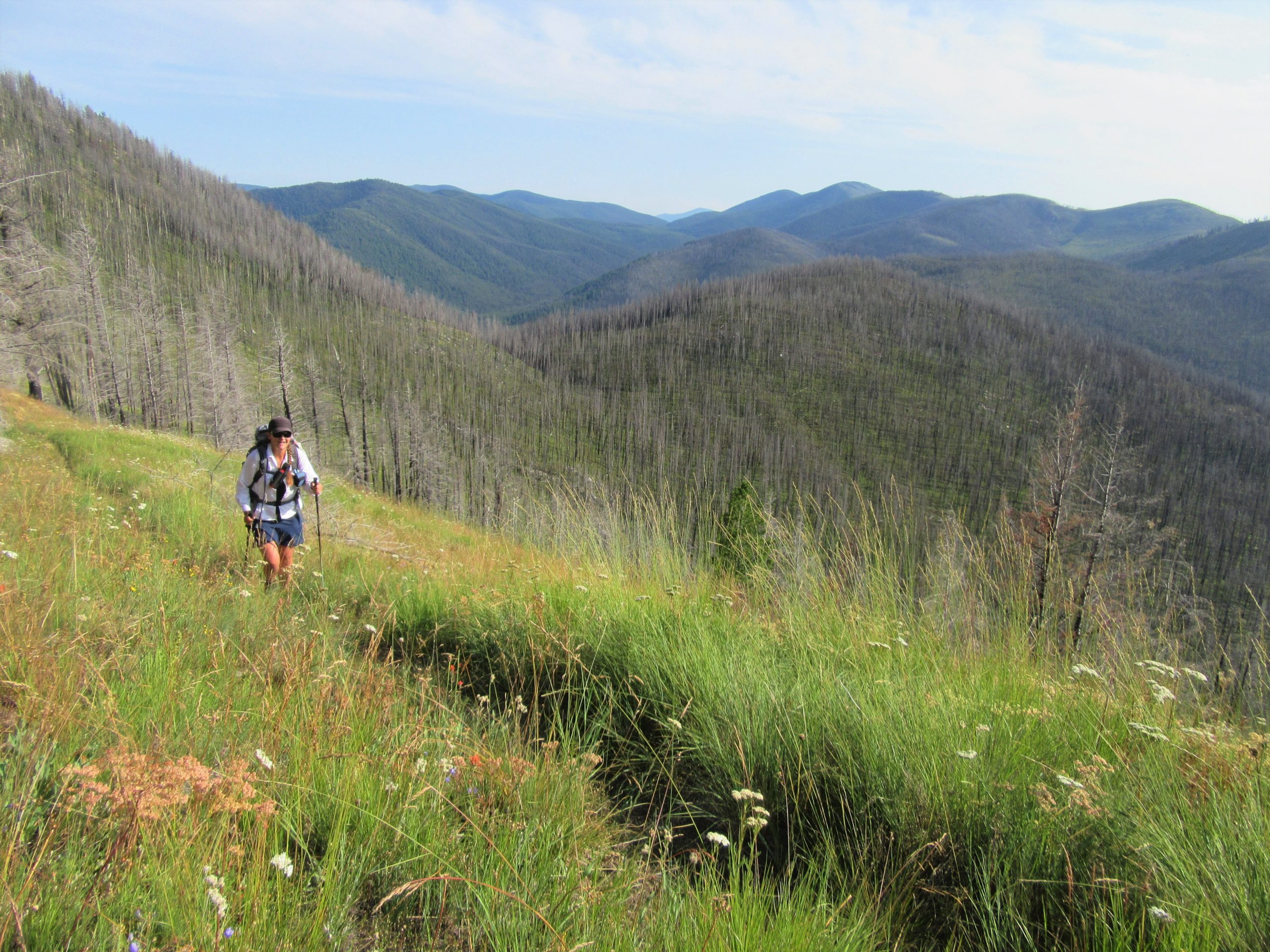
 Hikers hiking along Crowell Divide in Salmo Priest Wilderness in Eastern Washington
In the northeast corner, the foothills of the Rockies begin, plus you have the Selkirk Mountains and the Kettle River Range. The Kettle River Range is home to 7,000-foot peaks that are the oldest mountains in the state. They’re gentle, rather than rugged like the Cascades. They remind me a lot of the Smokies. There are a lot of open meadows and there’s tons of plant diversity.
 Hiker hiking in the Kettle River Range in Colville National Forest
What I love about the northeastern part of the state is the wildlife. More than half of the lynx in the lower 48 live in northeastern Washington. There’s a good chance you might see one of these big cats. There are moose and lots of cougar, and it’s the only place in the state with an established population of grizzly bears. There’s also a large wolf population in the state. After all these years of hiking the state, finally heard one of the packs when I was out in that area a few years ago. The wildlife is amazing in northeastern Washington.
In southeastern Washington and the Blue Mountains, near the Idaho and Oregon borders, the landscape is entirely different. It’s high plateaus and deep valleys, and gets really, really hot. Mountain Mahogany grows in the Great Basin Range.
Again, there are very few people in this part of the state, so you could hike for days and not see anybody. Southeastern Washington has one of the highest concentrations of cougars in the country. So if you’re looking for wildlife and remoteness, the northeast and the southeast parts of the state are the places to go.
Day Hiking: Eastern Washington / Amazon: check price / REI: check price
100 Classic Hikes in Washington
I wrote this book much later in my career because I had been establishing myself as one of the many outdoor writers covering the state. I should emphasize that a lot of Washington-based writers have a particular area that they cover, but I go throughout the entire state. It’s incomparably diverse, and it’s one of the reasons I love the state.
The original 100 Classic Hikes book was published in the 90s by two gentlemen in Washington; Harvey Manning and Ira Spring. These conservationists were icons in the guidebook world, having been around since the 1960s. They both passed in the early part of the 2000s. My publisher wanted the legacy to carry on. I got the honor of to take their 100 Classic Hikes book and keep 50 of their classics as legacy hikes. This was no trouble, because many of their classics are my classics, too.
When I took on this project, I expanded to cover more hikes across the state. Even though the original book was called 100 Classic Hikes in Washington, it only covered about a third of the state. The hikes were primarily in the Cascades, north from Mount Rainier, and the Olympics. They left a lot of the state out. I included the entire state.
What I did is I cherry picked the best places for these areas to really represent what the state is all about. Obviously, you can’t compare somewhere like Kamiak Butte, which is in the Palouse farmlands in eastern Washington, to Mount Rainier. But this book better represents the beauty of all regions of the state by discussing trails, wildlife and plant life, and is supported with beautiful photography.
100 Classic Hikes in Washington / Amazon: check price
Backpacking Washington: Overnight and Multiday Routes
This backpacking book was primarily written for the weekend or week-long trip. It’s not for long-distance backpacking trips or thru-hikes. Most of the hikes in the book are from 16 to 50 miles.
And again, the state has so much backcountry. With more than 30 wilderness areas, three major national parks, and seven national forests, there is some great terrain where you can go 10 miles in and be all by yourself and enjoy a calm experience.
My backpacking book appeals to trail runners, too. I’m a trail runner and I do ultras, so I’m familiar with 30-mile runs. This book has become a good resource for my ultra-running friends because they can easily find a great 25-mile loop for trail running in Washington.
I should emphasize, though, this is not a beginner backpacking book. Beginners who only want to go in three or four miles won’t find hikes like that in this book where lot of the routes are far longer. Instead, my day hiking books are perfectly suited for beginner backpackers. In those books, I do mention campsites and some of the regulations.
Backpacking Washington / Amazon: check price / REI: check price
Hiking Washington’s History
This is a very different book. I didn’t write the first edition. The original author, Judy Bentley, is a historian, an amazing storyteller, and a friend of mine. When she decided to do the second edition, she brought me on to add more description to the hikes through these historic areas.
I actually have a background in history. I grew up in New England, an area steeped with history, and I studied History at the University of Washington. History is one of my big loves. Even in a lot of my books, I always talk about history because it offers an entirely different way to appreciate the landscape. It’s another way to appreciate not just the wilderness and the wildlife, but the people that came here before us, whether it was the First Peoples, or the explorers and exploiters that came after.
I’m always amazed by how many people don’t know the origin of the names of these places they visit. They just hike. So many of the names of peaks come from native jargon, or they’re named after native people or settlers. There’s a story behind all these names and how they came to be.
So, we really took a holistic approach to the trails here. The history woven with the trail descriptions offers a new perspective to look at the land, beyond just a beautiful view. Readers can envision being a Yakama tribal member traveling through a mountain pass to trade with a Cowlitz tribal member. Or picture being a black person who grew up in the south and came out here to try to gain some control of their life and tried to make it as a hardscrabble miner.
There’s one story that I had a lot of fun with about hiking Monte Cristo, which is just a four-mile hike in the North Cascades. It’s about a former U.S. President’s grandfather who came over from Bavaria to a Washington mining town, ran a kind of questionable establishment there, made his money, and ran. What used to be home to 2,000 people is now a ghost town with around 12 buildings left.
Hiking Washington’s History / Amazon: check price / REI: check price
Urban Trails
Mountaineers Books’ Urban Trails series covers popular trails in urban areas. Each book is designed for people of all fitness levels, from walkers to runners to cyclists, who want to get outside for fresh air and some exercise. These guides lower the barriers to entry by highlighting trails that require less planning and offer shorter drives to get to the trailhead.
That’s the great thing about the Urban Trails books. I started doing this series to show people that you don’t have to go to the backcountry to enjoy great nature walks. You get wonderful walks right in these urban places.
Urban Trails: Vancouver, WA
Anyone who lives in Vancouver knows that they’re in the shadow of Portland, Oregon. People don’t realize you don’t really need to go to Portland. First of all, Vancouver is the birthplace of the state of Washington. It’s the oldest non-native settlement in the state, coming up on its 200th anniversary.
Vancouver has a lot of cool things to see and do, and the city is going through a revitalization.
There’s a very beautiful trail along the Columbia River. You’re going to get these great views of Oregon’s Mount Hood. Plus, you’ve got the National Historic Park there in Vancouver itself. Other notable places to visit in the vicinity include Longview, Battle Ground, Camas, and Yacolt Burn State Forest. So, lots of cool things right there without having to go south.
Urban Trails: Vancouver, WA / Amazon: check price / REI: check price
Urban Trails: Seattle
Seattle is a huge metropolitan area, and this particular book includes trails in Kent, Vashon Island, Shoreline, and Renton. One of the best things about hiking in this area is you can walk or ride your bike onto the ferry and be on Vashon Island, which is this big island in Puget Sound.
Puget Sound is pretty urban and growing up, but Vashon is still rural and lightly populated. There are all these parks and preserves that a lot of people who grew up in the area have no idea existed because it’s only been in the last 10-15 years there’s been such a push to protect the land.
Also notable about hiking near Seattle is you’ve got the longest stretch of protected coastline, in all King County. Again, that’s a county of 2.2 million people, but you take a ferry and can walk on this beach and be by yourself.
Urban Trails: Seattle / Amazon: check price / REI: check price
Urban Trails: Everett
This book covers trails in Covers Western Snohomish County, Monroe, Marysville, Whidbey Island and Camano Island. The best thing about the Everett trail community, though, are the islands: Whidbey Island and Camano Island.
Whidbey is one of the largest islands in the lower 48. It’s right up there with Long Island. Most of it is rural, it has a lot of reserves, and it has one of the longest stretches of public coastline. Walking in Puget Sound, you can go for about 12 miles under these amazing, 250-foot bluffs, that you can hike up on or hike below.
One of the reserves, Ebey’s Landing, is a National Historic Park. It’s an amazing place, and home to some of the oldest, non-native settlements and longest-farmed areas. The views are amazing. It’s one of those places you feel like you’re in Ireland as you’re walking across these green lawns, but then you’re looking at the Olympics, which surely means you’re in the northwest. There are lots of bald eagles and pelagic birds out in the sound. It’s one of my favorite places. Actually, Ebey’s Landing is in my 100 Classic Hikes book, too.
These islands are very, very easy to reach, to experience. Camano is accessible by bridge. Whidbey has a bridge, as well, and in the southern part, there’s a ferry that goes across that every half hour. So, the islands are a good escape from the more populated parts of Puget Sound.
Urban Trails: Everett / Amazon: check price / REI: check price
Urban Trails: Tacoma
Tacoma, generally, is an industrial area. It’s had a bad reputation for years, but Tacoma is going through a revival right now. It has a beautiful waterfront with lots of parks, and you can walk for miles there.
I’m going to make a statement here based on personal experience and extensive travel; Tacoma has one of the finest urban parks, not only in Washington, but all of America. Point Defiance Park is just an incredible place. It’s 700 acres on a peninsula with old growth forest. There are miles and miles of trails, and you can hike up the spine of this park and this old growth forest and not even realize you’re in Washington’s third largest city. That’s really special.
And then, Anderson Island; I love the islands. Again, so much of Puget Sound is deserving, but you can get on a ferry and get into all these islands that are right on the sound and be worlds away. Anderson is another one of those special places where the planes are flying in from nearby Sea-Tac, but you’re walking on a deserted beach.
In addition to Tacoma and Anderson Island, this book includes hikes in Maple Valley, Green River Gorge, Auburn, Federal Way, Black Diamond, Enumclaw, Lakewood, Orting, Puyallup, and DuPont.
Urban Trails: Tacoma / Amazon: check price / REI: check price
Urban Trails: Eastside
This area includes Redmond, Snoqualmie Valley, Bellevue, and the Issaquah Alps. Eastside has grown in the last several years, partially due to the tech boom. For example, Redmond is the heart of Microsoft. Bellevue used to be a sleepy suburb. Now, it’s all steel and glass and high tech. What a lot of people don’t realize, though, is with all that high tech and suburban growth come some of the largest urban parks in the country.
I briefly mentioned Harvey Manning, that iconic guidebook author from back in the day. He grew up in this area when it was really rural, and saw the change coming. He was responsible for protecting Cougar Mountain, Squak Mountain, and Tiger Mountain. All of those are part of the Issaquah Alps, which is actually a term he came up with.
The Issaquah Alps is tens of thousands of acres, with 2,000- to 3,000-foot peaks and a couple hundred miles of trails, all easily accessible to the more than two million people living in the Seattle area. Because this is a temperate area, usually snow falls only on the mountains. Lots of times, there’s no snow in low country, so you can continuously hike this area all year.
And then the Snoqualmie Valley is nearby, approximately 20 miles from Seattle. This area has retained a lot of its rural charm. There are farms and wildlife reserves on the river, and 30-mile-long rail trails for people to walk and enjoy. It’s truly pastoral. That, to me, is the allure of the area.
Urban Trails: Eastside / Amazon: check price / REI: check price
Urban Trails: Bellingham
This is a great area between Seattle and Vancouver, B.C. This book covers all of Bellingham, as well as the Chuckanut Mountains, Western Whatcom and Skagit Valley.
The Skagit Valley has some of the last stretches of rural farmland between those two big metropolitan areas. The Skagit River is one of the largest rivers in Washington. It’s a very, very popular area for winter birds, and is home to the largest wintering snow geese population.
The allure of the Chuckanut Mountains is that this the only place in Washington where the Cascades actually meet the Salish Sea. So, you can hike right above the Salish Sea, above the Sound. These peaks are only around 2,000 feet tall, but you get these wonderful views up into British Columbia, and then across the San Juan islands and the Gulf Islands. Sunsets are spectacular.
The Chuckanut Mountains aren’t difficult to get to. For the most part, they stay snow free. It’s an area that I go to frequently to run the trails. I can get a good workout in close to home rather than having to go into the hardcore mountains.
Urban Trails: Bellingham / Amazon: check price / REI: check price
Tips for Hiking Washington State
When not writing about the outdoors I’m out in them. I’ve hiked more than 30,000 miles in the State of Washington. I have also guided in France and Spain, and have worked as a backcountry ranger in New Hampshire’s White Mountains.
As a guide, it’s my job to ensure clients are prepared and safe, especially now when people are finding so much information on the internet. They see a pretty picture and they want to go there, but they don’t realize how tough the terrain is, how challenging the weather can be, or how bad the avalanche situation or river crossings can be. Here are the most important things I can share with people looking to go hiking and backpacking in Washington.
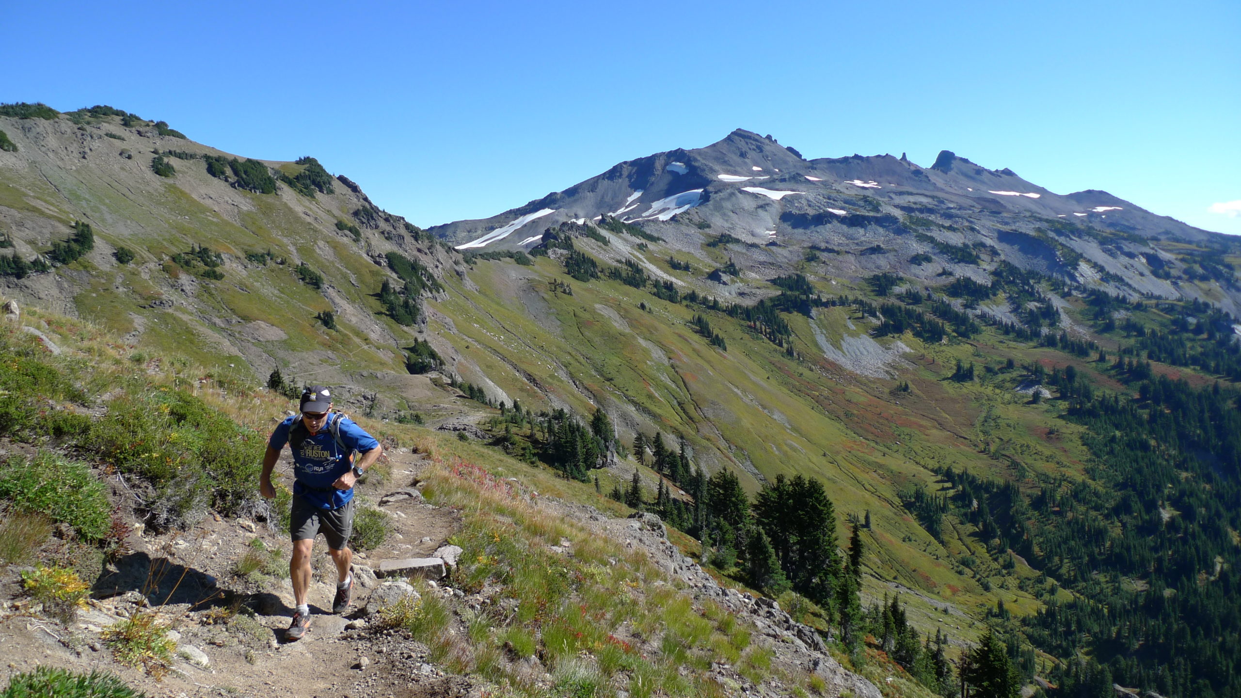
 Hiking Tatoosh Ridge near Mount in Rainier Tatoosh Wilderness
Tip #1: Pace Yourself and Plan Accordingly
The biggest mistake people make when they hike in Washington is that they want to go everywhere. Washington has three major national parks, seven national forests, and so much public land. Visitors want to do it all, and they just can’t. They’ll spend a lot of time driving and not seeing anything.
Even though Washington is the smallest state west of the Mississippi, it’s still a big state compared to most of the East, and the national parks are big, too. For example, Olympic National Park is almost a million acres. You can spend weeks just hiking in Olympic National Park. I’ve spent years hiking there. It’s amazing.
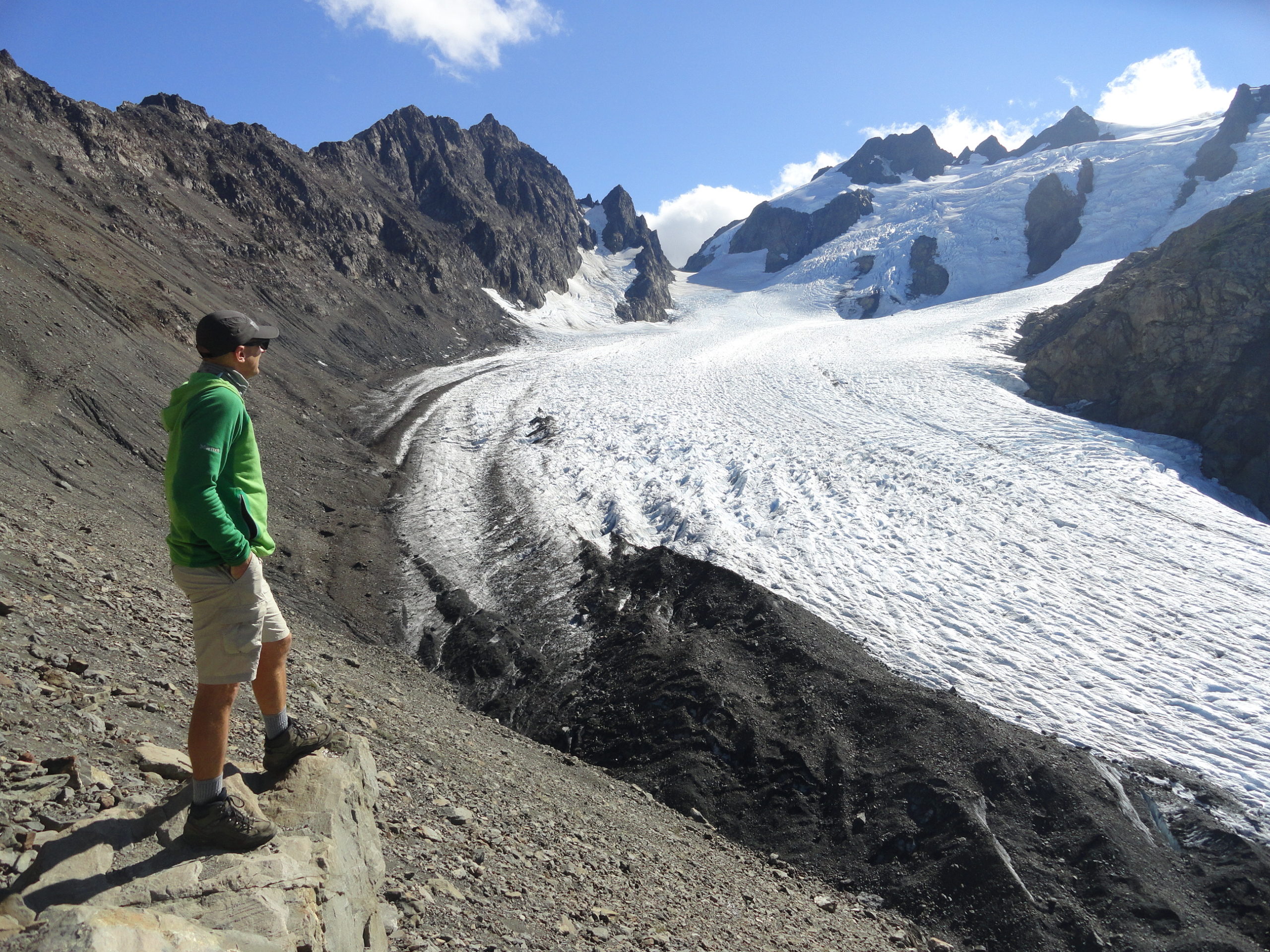 Hiker overlooking Blue Glacier on Mount Olympus
Even the Olympic Mountains alone, you’re looking at three distinct ecosystems to experience on foot. There you get the alpine, old-growth temperate rainforest and you’ve got a wilderness coast. Individually, each of those ecosystem areas are places you could spend weeks exploring.
So, my tip is to concentrate on prioritizing one or two areas. Just come out to the Olympics, or to see Mount Rainier, or the North Cascades. Make several trips. There are just so many quality trails and fine places to visit.
Tip #2: Be Prepared for Weather
Washington has a reputation for being a wet place, and it can rain for weeks. If you’re coming out in the fall, be prepared for the rain; in the spring, be prepared for the rain.
Know that the weather here will wash out trails and take trees down. It’s so important to be aware of this when planning to hike and backpack in Washington. I recommend researching trail status in advance. Just knowing that there’s the possibility that you’re not going to be able to get to the trail, or a bridge might be out, or you might not be able to get across the river until August, is important.
Summers are wonderful out here. From mid-July to mid-September, it’s just amazing. You can actually have periods with no rain. A lot of people have a hard time imagining that. Every time I go for a hike, I have two things in my pack: a rain jacket and sunglasses. Washington has so many microclimates and weather is always changing.
Washington has a fire season, too. Most folks think primarily of California, but we’ve had some bad fires out here in recent years.
Something many people don’t realize is that Washington has so much snowfall that a lot of the trails are only safely open for a few months of the year. We have avalanche danger in winter and spring, and it can be intense. We’ve had some very unfortunate instances where people visit Seattle in springtime and it’s 70 degrees in the city, but they get up into the Olympics and encounter avalanches. It’s definitely something to be aware of.
Don’t even think about crossing a dangerous snow unless you know what you’re doing. That means you know how to read avalanches and have the right gear, like an axe, to attempt to rescue yourself.
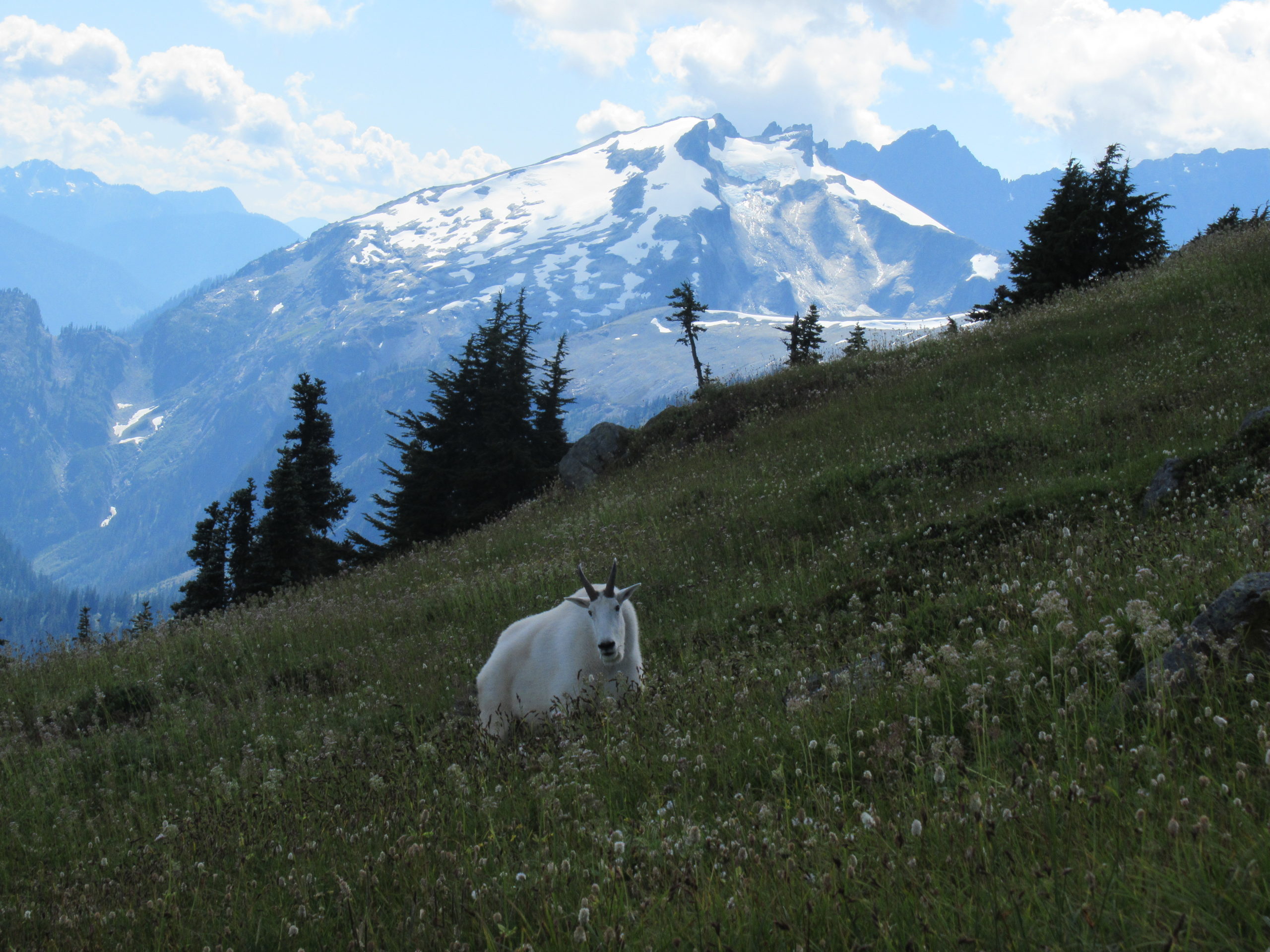 Mountain goat feeding on Copper Butte in North Cascades National Park
Tip #3: Brush up on Wilderness Awareness
Many newer hikers, people getting introduced to hiking via the internet, rely way too much on technology. Technology is not going to help you when you’re in an area without cell service. If you get in trouble there might be no way to get help. So, I can’t emphasize enough how important it is to take the time to be prepared. And likewise, with food–pack plenty for performance.
The North Cascades particularly are not a place where you can cut corners and just head into the backcountry with a smart phone and a bottle of water. You really need to be prepared for hiking in Washington state. I mention in all of my books the importance of packing the Ten Essentials. You should always have them when you’re going to the backcountry. You should also research your route and share your itinerary with someone who is not on the trip with you. That way somebody knows where you’re going to be if there’s trouble.
Even though people from other parts of the country think the northwest is remote, some of the trails are really crowded. A lot of people are moving to King County, which is where Seattle is located. It’s the 12th-most-populated county in America. We’ve had a lot of search and rescues (SAR) lately. So many people are hitting the trails, which is amazing, but the SAR efforts have been really, really tough.
 Ptarmigan Ridge in Mount Baker Wilderness
Tip #4: Know Your Limits
Walking three miles up 3,000 feet on a rocky terrain is not the same thing as walking three miles in the city. Many people underestimate their fitness level, or they don’t realize how difficult some of this terrain can be.
Another common issue is underestimating the amount of time it can take to get to some of Washington’s hiking scenic spots. So, people will leave late in the day, not realizing the terrain difficulty. Sometimes they don’t have the proper gear and they run into trouble.
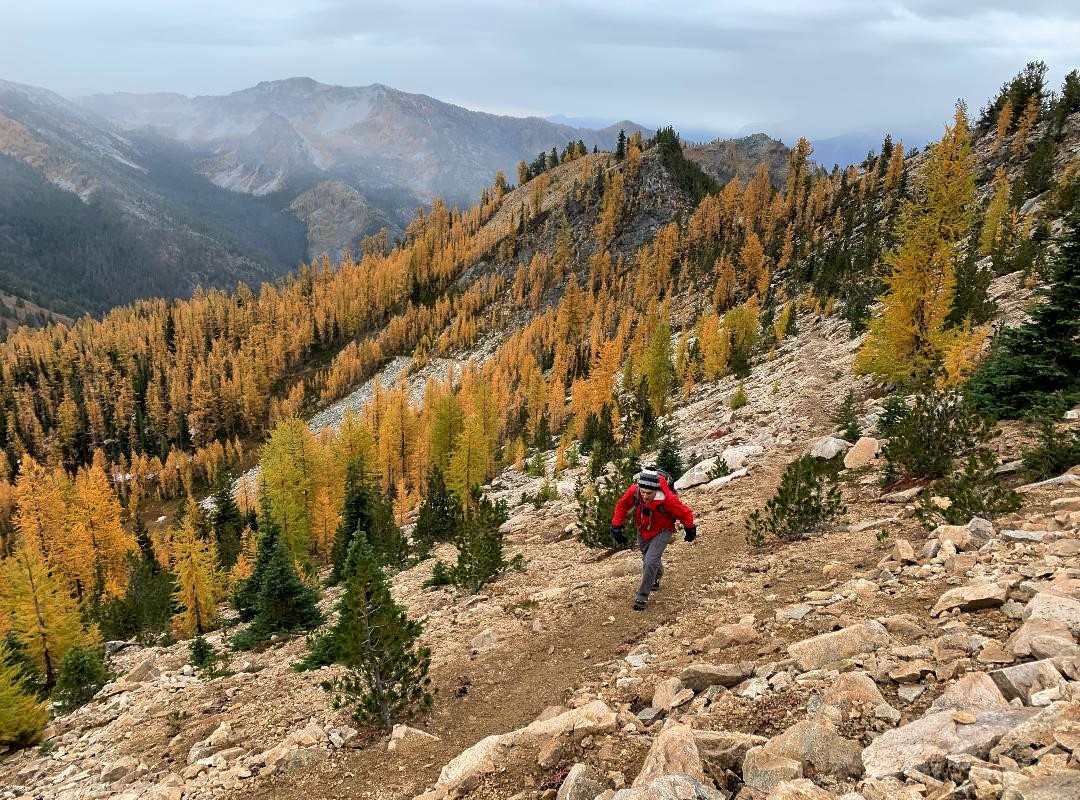 Craig Romano ascending Boulder Butte in the Lake Chelan National Recreation Area