Yellowstone’s Best Trails and Advice for Hiking and Backpacking
If you’ve been thinking about planning a hiking trip and are wondering what you need to know about hiking in Yellowstone National Park, our guest, Garrett Tovey has your back. Garrett is a wildlife biologist, environmental educator, thru hiker, and avid outdoorsman. He has crafted a career that brought him to work in open spaces many people might only visit once or twice in their lifetime. Before his current position as the Director of Education for the Glacier Institute, Garrett spent two years in a variety of instructor and naturalist guide roles at Yellowstone National Park.
Boasting more than 900mi of trails and 15mi of boardwalks, Yellowstone has everything from short walks to days-long backpacking treks. Whether you’re summiting Avalanche Peak, backpacking the Lamar Valley Trail, or hitting all the tourist hot spots via boardwalks, your body could benefit from conditioning to prepare for the extra time spent on your feet. Check out Fit For Trips’ custom training programs or schedule a complimentary fitness consultation with Marcus Shapiro.
Yellowstone is the first national park in the United States, earning its designation in 1872, when President Ulysses S. Grant signed the Yellowstone National Park Protection Act into law. This iconic park is home to geysers, lakes, rivers, waterfalls, forests, wide open spaces, and has plenty of opportunities to spot wildlife.
View this post on Instagram
Top 3 Need-to-Know Tips for Hiking in Yellowstone
We asked and Garrett answered: Folks need to be a little bit smarter when it comes to safety and hiking in both the backcountry and front country in Yellowstone. As a former naturalist guide in Yellowstone National Park, these are the three most important things I’d like to pass on to hikers coming to Yellowstone.
- Abide by Leave No Trace principles.
Being informed about what each principle means, and abiding by them, is crucial to keep our wild spaces wild. Huge numbers of people are going into the wilderness now, more than ever. We don’t want these spaces restricted because of overuse. It’s crucial to make sure we leave no trace. - Avoid negative wildlife encounters.
As a biologist by training, we want to make sure that we give wildlife space. Don’t become the subject of those articles you read about people getting too close to a bison or too close to elk in Yellowstone. We want to make sure that we give plenty of space to wildlife. Park rules state that you must maintain a distance of 100yd for bears and wolves and 25yd for all other wildlife. However, my personal rule is if you’re altering that animal’s behavior, you’re too close. So, you could be 200yd from a grizzly bear or a wolf, but if your presence is making it do something that it’s not normally going to do, then you’re too close. So, we need to make sure we give wildlife plenty of - Respect the fragility of thermal areas.
Please stick to boardwalks. It’s something that we see all too often, someone just stepping off the boardwalk to test the temperature of the water or to pick up a pamphlet that they dropped. They don’t realize that the crust underneath them could be only an inch thick and can break very easily. Not only does it damage these fragile thermal features, you can get seriously hurt or even die from your injuries. It’s no joke.
View this post on Instagram
A Primer on Visiting Yellowstone National Park
What is the best month to visit?
For hiking, hands down I recommend September as the best month to visit Yellowstone. You have the incredible leaf change for the cottonwoods and the aspens. You have crisp, cool mornings. A lot of folks have gone back to school and so you don’t get the crazy crowds. The elk have started to bugle. There’s even a good chance of seeing snow. So, it’s just a beautiful seasonal change happening in Yellowstone.
Does Yellowstone have good hiking?
Absolutely. I think it’s definitely one of the best spots to hike in the lower 48. Thanks to the open expanse of land, your views are just unmatched. I would definitely say Yellowstone has some of the best hiking out there, for sure.
Is it safe to hike alone in Yellowstone?
You’re going to get a lot of different answers on that. I specialized my research as a bear biologist, and a lot of people always say, “In grizzly country, you never hike alone.” I personally prefer to hike alone because I’m educated in bear safety. I don’t think there’s any problem with hiking alone if you are prepared to be in bear country. If you’re play it smart, if you make noise, and you always carry bear spray, I don’t see any issues hiking alone.
I think your chances of seeing wildlife is definitely increased when you hike alone, which is something I prefer. Also, a lot of people go into the wilderness to seek that solitude and to personally reflect, and I think that’s definitely a benefit and is certainly enhanced when you hike alone.
So, as long as you’re prepared and you have the right skills and knowledge, there is no problem with hiking alone. However, for a novice or a beginner, certainly, who’s not familiar with hiking in grizzly bear country, I certainly wouldn’t recommend it.
View this post on Instagram
How many days in Yellowstone is enough?
For hiking, I would say five to seven days is sufficient to experience a little bit of everything and see what each of the elevations has to offer. You’ll never be able to see it all because the park is just too vast. Hiking-wise, if you did three or four day hikes, maybe even an overnight, I think you could really get an idea of what Yellowstone has to offer, for sure.
Are there mosquitoes in Yellowstone?
Absolutely. However, due to the temperature and the elevation, the mosquito season is much shorter in Yellowstone than other parts of the country. It’s hard to gauge when it will happen because it varies every single year by the amount of winter snowfall.
When you have late or you have a heavy winter snowfall, of course, that snowpack stays on the ground much later. Generally, the early summer is when you’re going to get those hatches. Later in the summer, when it starts to dry out, is generally safer in terms of not seeing the massive numbers of mosquitoes.
Between May and early July, you’re going to have mosquitoes, for sure, on most trails in the park. When you get higher up in elevation, with prolonged snowpack or late-season snows, it’s easier to avoid bad spots in terms of mosquitoes. They don’t do well with freezing temperatures.
Down in the lower elevations, when you have that earlier snow melt and it turns into soggy grounds or even what we call ephemeral ponds, or these seasonal ponds, that’s when you can have those mosquito hatches.
What is the elevation in Yellowstone?
Per vertical mile you can get a lot of variable habitat and terrain with 5,000ft elevation difference. Gardiner (5,259’) and up by the North Gate is around that 5,000ft mark. Of course, there are peaks a little higher (highest point – Eagle Peak at 11,367), but generally speaking, the highest points on commonly-used hiking trials are just over 10,000ft.
View this post on Instagram
Do I need hiking boots for Yellowstone trails?
I don’t think so, but I’m personally a fan of trail runners. I like to move quickly on trails and carry a light backpack and just go. You don’t need boots for most of the shorter trails or for day hikes. However, if you’re backpacking and carrying 60lb on your back, you’re going to need the support and protection of sturdier boots.
How much water should I bring to hike?
As a former lead instructor with Yellowstone Forever, my number-one recommendation for Yellowstone’s visiting hikers is to never underestimate the amount of water that you need. There are a lot of issues with hikers experiencing dehydration in the park. Yellowstone has a very dry climate. Additionally, it’s typically a lot higher in elevation than what folks are used to, and you can get elevation headaches, which you can usually alleviate with more water.
So, generally speaking, carrying a liter per hour of activity is safe. If you can’t carry enough water, bring water filtration for when you get water from creeks and streams. Bottom line, a little plastic, 12oz water bottle is not going to cut it for the day. You definitely need to stay hydrated.
View this post on Instagram
Getting Around Yellowstone National Park
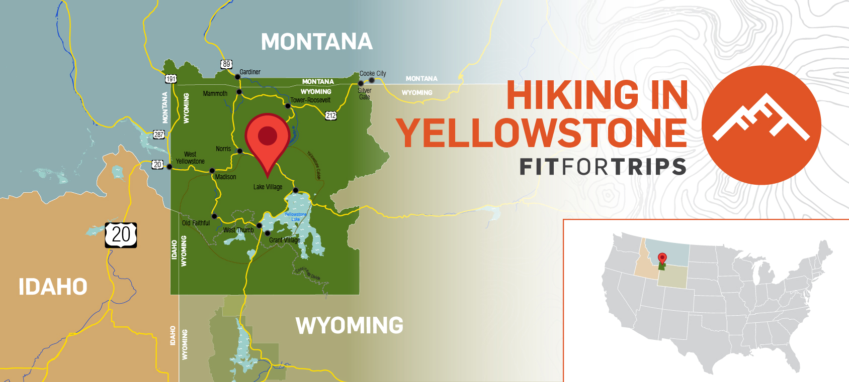
There are five main entrances. The most popular entrance is West Gate in West Yellowstone, and the second most popular is the North Gate in Gardiner. Then you have the Northeast Gate, and that’s the Cooke City/Silver Gate entrance. You have the South Gate that goes down to Grand Teton National Park, and you have the East Gate, that if you were to continue all the way out, you would eventually wind up in Cody, Wyoming. So, five main entrances.
View this post on Instagram
In terms of parking lots, the main road in Yellowstone is a figure eight shape, and it takes all day to drive that figure eight. There are tons of parking lots spread out over that figure eight with access to tons of park attractions and trailheads. So, unlike national parks like Yosemite or Zion, where you might have to park your car and then hop in public transit, you can actually drive your car to almost any access point in Yellowstone.
The furthest park entrance from the core figure eight is probably the Northeast Gate, which is also the most remote entrance. That’s best utilized in the summer months because you can go up and over the Beartooth Pass, say, from Red Lodge coming into Cooke City, and then that takes you all the way through Lamar Valley, and then you’re tying back into the figure eight there, at the Tower Junction.
If you want to know trail status before getting to Yellowstone, I’d go to the National Park Service site or Google “Yellowstone trail status.” You can find backcountry situation reports on nps.gov, plus see current trail status and general conditions.
View this post on Instagram
Best Hikes in Yellowstone
This is tough because there are so many excellent trails in Yellowstone. It really depends on what you’re after. The cool thing about Yellowstone, and I could even say it’s even better than Glacier in terms of the accessibility, is that you don’t have to be an expert to hike in Yellowstone. You don’t have to be a pro at orienteering or navigating or be an expert with gear.
I think Yellowstone offers a little bit for everyone. You just have to know your skill level and what you’re comfortable with doing. There are easy hikes completely along boardwalks in the lower Geyser Basin. You can spend all day hiking the lower Geyser Basin seeing popular attractions such as Old Faithful and other geyser eruptions. Before you know it, you’ve hiked over 5mi. There’s just some really, really cool spots that are completely accessible, even via wheelchair.
View this post on Instagram
For example, from Midway Geyser Basin, the walk to see Grand Prismatic Spring up close is only a tenth of a mile along a boardwalk. You’re looking at the spring from eye level, so you’re not going to get the incredible, majestic colors that you would get if you were to hike to the overlook (more about that later when I talk about a hike to Fairy Falls). However, this boardwalk is wheelchair accessible.
In general, there are tons of amazing trails for traditional hiking to enjoy throughout Yellowstone.
View this post on Instagram
Scenery and Wildlife Hikes
Mount Washburn – scenic hike
To me, is probably one of the best hikes in the park. You’re going near Dunraven Pass and just a really cool spot in the park that a lot people just drive by quickly, but it offers some incredible views. That’s kind of the central area of the park, and so you get some awesome, awesome views. You’ll summit just over 10,000ft, so it’s a cool, easy hike to get to that elevation, which a lot of people want to make sure they hit.
You start this hike in Dunraven Pass. Also, just note that it gets closed quite often because they’re doing construction on Mount Washburn. You’ll definitely want to check trail status before heading to this one.
View this post on Instagram
Mount Everts – wildlife hike
Mount Everts is a plateau that you can access from a few different points. I recommend beginning near the Lava Creek trailhead and exiting at the Rescue Creek Trail. It’s just a really, really cool off-trail hike. I love it because no one’s ever on it and you have the ability to see some awesome signs of wildlife. I almost always see cougar signs up there, and I’ve heard wolves howling from the summit. It’s just a really, really sweet hike that no one really knows about.
View this post on Instagram
Storm Point – easy short hike
One popular Yellowstone hike is Storm Point. This family-friendly hike is very, very easy. It’s just over 2mi round-trip and it’s virtually flat; there is hardly any elevation gain at all as you travel along the shore of Yellowstone Lake. That lake is massive, it feels like it’s an ocean, so the views of weather changes are epic here. You’re watching just the waves slap against the shore.
It is important to mention that this trail goes through prime bear habitat. As with any other hike in Yellowstone, even if you’re on boardwalks, I always recommend carrying bear spray. I’ve seen multiple grizzly bears on Storm Point, even though it’s a quick and short hike. It is an area where they like to hang out. Bison will also hang out along the trail, and you have to give them a wide berth. But it’s a really cool hike and I highly recommend it.
View this post on Instagram
Trout Lake – moderate hike
For a hike with moderate effort, I recommend Trout Lake. Everyone sees Trout Lake on a map and thinks that because it’s 2mi round trip that it will be easy, but it is basically a half-mile of pure elevation gain. If your lungs are acclimated, it can be pretty easy and it gives you some awesome views. Otherwise, you’ll probably want to take this one a bit slower.
You’ll have a really good chance of seeing wildlife up in Trout Lake basin. It’s in the Lamar Valley, and you’ll hike north from the road. It’s a really cool scenic hike and it’s pretty easy, but like I said, a lot of people underestimate it thinking that it’s flat when it’s really not.
View this post on Instagram
Avalanche Peak – hard short hike
I would say Avalanche Peak is on my personal list of toughest hikes in Yellowstone National Park. It’s a very, very steep climb. You’ll get around 2,100ft of elevation from the trailhead, and it’s a little over 2mi each way, so around 4.5mi round trip. The trail goes straight up, but it gives you incredible views of Yellowstone Lake.
Just know, in addition to the elevation gain, this trail has loose footing and uneven terrain. You can fall pretty easily on that hike. Trekking poles might be helpful.
View this post on Instagram
Day Hikes in Yellowstone
Bunsen Peak – day hike
This peak is an awesome day hike, and you’ll gain a decent amount of elevation. It’s relatively short driving distance from Mammoth. Bunsen’s summit is 8,564ft and gives you a really, really cool panoramic view of the landscape. There’s an old weather station and cabin watchtower on top. You can’t actually get into the tower, but it’s a cool spot to stop, get out of the wind, and eat lunch.
I would not say it’s super strenuous; it’s probably a more moderate hike. It definitely isn’t incredibly easy. It’s certainly not flat, but it is an incredible hike. It’s an awesome hike to do as a family or with a group.
View this post on Instagram
Yellowstone River Picnic Area – day hike
This is at the northern terminus of the Grand Canyon of the Yellowstone. Here you can kind of hike along the canyon and see some really cool thermal features. A lot people don’t realize those thermal features are there, in Yellowstone River. And it’s a really cool spot to look for mountain lion signs. You can also see bighorn sheep on that trail. It’s a really, really fun one.
View this post on Instagram
Black Canyon of the Yellowstone – long day hike
This one is a longer day hike. The trail is about 20mi and moderately busy. But it’s an epic hike, to go from Tower Junction out and you come out, actually, into the town of Gardiner, at the North Gate.
View this post on Instagram
Yellowstone’s Best Waterfall Hikes
There are so many excellent waterfalls to see in Yellowstone National Park. They have varying levels of difficulty to reach, so there’s a good chance everyone will find at least one waterfall to visit based on accessibility needs and skill level.
Fairy Falls
One of the most popular trails in Yellowstone is probably to the Grand Prismatic Overlook, which is accessible from the Fairy Falls trailhead. Everyone wants to get that view, but the photos you’ve seen published were aerial shots, so from the overlook you don’t quite get the same view.
If you hike to the overlook from Fairy Falls Trail, round trip I believe it’s like 1.3mi. It starts off on a very easy trail, and the last 0.2-0.3mi to the top is pretty steep. It leads to a fenced-off overlook. It’s a decent hike that you actually have to have some sort of physical ability, but that’s going to give you the best view.
Once you’ve taken your photos, I recommend continuing past the overlook, because Fairy Falls is an epic hike. It’s a really cool waterfall, especially in the early season when you have a lot of spring runoff. It’s a very easy, very flat hike. You can actually get in and swim at the base of the falls. You’ll be in a lot of people’s photographs, but it is a nice, refreshing hike to do in summertime. August is the best time of year to swim.
I would stress that’s just for Fairy Falls. I wouldn’t recommend swimming anywhere else in Yellowstone just due to the thermal features. Please pay attention to swimming closures and be aware of thermal activity in the area. Please abide by all park rules.
View this post on Instagram
Dunanda Falls
This is a really cool waterfall in the southwestern corner of the park, in the Bechler region. I actually think the Bechler is the most beautiful part of Yellowstone National Park. It’s very remote and not visited very often, so the landscape is mostly untouched. There are some incredible trails in that area, and it’s away from the crowds and hustle and bustle of West Yellowstone.
You’ll see some awesome thermal features in Bechler, plus beautiful waterfalls, including Dunanda. You can reach Dunanda Falls via the Bechler River Trail and Boundary Creek Trail. Those are two of my favorite trails in the area.
Bechler is one of the wettest parts of the park and is subject to late- and early-season snow, so the hiking season in Bechler is very limited. It’s an elevated plateau, one of the higher elevations in Yellowstone, so that just pushes the season a lot shorter than other parts of the park. I recommend visiting in August and into early September. You have about a six-week window to hike there. In the early season you’ll have delayed mosquito hatches and snow, and in the latter half of the season you’re going to run into early snows there.
View this post on Instagram
Mystic Falls
I think this waterfall gets overlooked, but it’s a relatively short hike and is great for families and is easily accessible to people staying in the Old Faithful area. At around 2.5mi round trip, Mystic Falls is a cool hike that starts at the Biscuit Basin trailhead and only gains around 150-200ft in elevation, so it’s relatively flat.
This terraced waterfall is about 70ft high, and it’s a beautiful. It gives you one of those cool, overhead views. It’s not a super popular trail, so you might have the views all to yourself.
View this post on Instagram
Lower Falls
The most epic falls in the park is the Lower Falls in the Grand Canyon of Yellowstone. Hiking along the Ribbon Lake Trail is really, really cool, right along the Lower Falls there. Seven Mile Hole is also another one that will take you along the rim of the Grand Canyon, and you get to look back and check out cool views of Lower Falls. For short walks, you can hop on Brink of the Lower Falls for an up-close view, or the Red Rock Point Trail. These are accessible from North Rim Drive.
Hiking the Grand Canyon of the Yellowstone
The canyon is a large, natural feature carved out by the Yellowstone River and is roughly 20 miles long. It is drivable, and many excellent viewpoints are easily accessible by car. However, if you’re looking to do some hiking, there are trails for that, too.
So, there isn’t just one hike that covers the entire Grand Canyon. There are a bunch of short trails to nice viewpoints, such as Brink of the Lower Falls and Brink of the Upper Falls. There are also some longer trails that have varying levels of accessibility to views.
North Rim Trail
This trail in Grand Canyon of the Yellowstone connects to canyon-area lodging. So, if folks are staying in some of the lodges at Canyon Village, this trail connects a lot of different viewpoints along the North Rim, like Inspiration Point, Brink of the Lower, and Brink of the Upper.
I wouldn’t say it’s incredibly scenic in its entirety, but it’s popular for those visitors staying in or visiting Canyon Village. It’s just an easy spot where at any point you can hop on and off. If you’re driving into the North Rim, you’ll benefit from easy trailhead access to your car because the trail basically parallels the road.
View this post on Instagram
South Rim Trail
The South Rim Trail essentially connects Uncle Tom’s Trail to Artist’s Point. If you have limited time to see the sights in Yellowstone, I always recommend a stop at Artist’s Point. It can get crowded, but it is by far the most quintessential view of Yellowstone. It is an incredible spot to see the Lower Falls and the Grand Canyon of the Yellowstone. It’s just an amazing, amazing viewpoint.
View this post on Instagram
Uncle Tom’s Trail
This isn’t really a hike, per se. Uncle Tom’s Point is a scenic area at the end of a parking lot halfway down South Rim Drive. They’ve done some construction on Uncle Tom’s Trail, so there have been, and may still be, some closures. At one point, there was this really old, rickety metal staircase that you could take down to the base of the Lower Falls and get sprayed by the mist. It’s always worth checking the NPS site for information about closures.
From Uncle Tom’s Point you can walk the South Rim Trail and will be downstream from Upper Falls looking back at it, and when you look downstream, you’ll see where Lower Falls spills over. So, it’s kind of a little midway point, but there’s a massive parking lot with vault toilets and a small pavilion.
View this post on Instagram
Backpacking in Yellowstone
Electric Peak – hard day hike or backpacking
One of the harder hikes in Yellowstone is to the summit of Electric Peak. Electric Peak sits in the northwestern portion of the park. It’s the highest peak in the Gallatin Range, and it’s just shy of 11,000ft. Round trip, this hike is close to 20mi. So, distance wise, it’s not all that menacing, however, it is a very, very steep elevation climb.
View this post on Instagram
Lamar Valley Trail – easy backpacking
This trail is virtually wide-open, shooting south through Lamar Valley and crossing Lamar River. There are some easy backpacking routes to do off this trail. If you were to take the whole trail, I want to say it’s close to 35mi long, heading south towards Pelican Valley trailhead and that area just past fishing bridge. But yeah, it’s very easy, probably one of your easiest backpacking routes.
There aren’t many easy hikes in Lamar Valley, and everyone wants to visit because the high probability of spotting wolves. The best chance is to get away from the road out on this long trail. It’s an easy, flat hike and gets you away from the crowds in Lamar Valley.
View this post on Instagram
Hellroaring Creek Trail – backpacking
Hellroaring Creek is where a lot of folks will start the Black Canyon of the Yellowstone hike. It’s a common backpackers’ trailhead, but it also ties into some day hikes. Most folks start it going down to the suspension bridge. There’s a really cool scree field right at the trailhead where you can spot pika. From the trailhead you can plan two or three different overnighters, including treks to Specimen Ridge, Slough Creek, and the Garnet Hill loop.
View this post on Instagram
Navigating Yellowstone’s Trails and Open Spaces
Many trails in the park are well-marked and well-traveled, so getting around should be pretty easy. However, it’s important to come prepared with paper maps or GPS apps.
You will not have phone service throughout 90% of Yellowstone, so relying on things like Google Maps and AllTrails can be dicey.
I like to use Gaia maps, Avenza, or onX maps. To me, they’re just more accurate in terms of the actual trail itself. You know, All Trails is a quick reference if I’m looking at the exact mileage of something or maybe how to find the trailhead, but that’s about as much as I use it for.
onX is a mapping software based out of Missoula, and they mostly just do GPS maps. That’s great. I know they kind of got popular from hunters using it to find out if you’re on public or private lands. That’s a great software. Similarly, Gaia, you can actually turn your phone or tablet on airplane mode and still track your location because it’s using GPS instead of approximating your location based on nearby cell towers.
I also use Avenza. This app allows you to download the park map layers and utilize your phone’s GPS capabilities, so you can put your device in airplane mode and save battery. The app keeps track of where you’re at and, oftentimes, the actual trails are visible on the map layer, so you can make sure that you’re on the trail. Avenza makes it easy to identify the peaks you’re seeing around you, and see if there are any official or social trails that lead to them. It’s just a really cool mapping capability without having to utilize your phone’s service.
Can You Hike Off Trail in Yellowstone?
You can hike off trail, however, not in thermal basins. So, when you’re in thermal areas, which are mostly on the western side of the park in the caldera, you’re restricted to walking on designated boardwalks. However, in areas outside of the thermal basins, you are allowed to hike off trail, which is something a lot of people don’t know. So, if you see something cool and you want to meander towards it, you’re able to do so. Obviously, keep in mind the wildlife safety restrictions.
Generally, I would not recommend off-trail hiking if you’re not very experienced with orienteering. Orienteering relies on your ability to use a map and compass to find trails. If you’re not experienced you may become a cautionary tale told by the local search and rescue team. So, off trail-hiking is not for the beginner or even novice hiker. I would definitely recommend only doing that if you have orienteering skills and you’re comfortable hiking off trail and are very familiar with Leave No Trace principles.
If you don’t have orienteering skills but you have a GPS watch with maps, you might be okay to go off trail a little bit. I only recommend this if you’re comfortable using the technology and are certain of your ability to find your way back.
Compare and Contrast Hiking in Yellowstone and Glacier
I did grad research in both; Yellowstone and Glacier, and worked in both, and I’m currently in Glacier. The majority of Yellowstone is located in the northwest corner of Wyoming, with a little bit of the park boundary spilling over into Idaho and Montana. Glacier is six hours away in the northwest corner of Montana, so geographically it’s important to realize they’re not close to each other and the landscapes are completely different.
Generally speaking, Yellowstone is a lot more open. It’s 2.1 million acres, and a lot of the hiking is in open meadow, alpine meadow, or rolling plains. You usually have a large range of view. Yellowstone is very, very open, and that’s why the wildlife watching there is so incredible.
I always say the Glacier has the ruggedness of the Tetons, but the expanse of Yellowstone. Glacier is just completely different in terms of terrain. Due to glacial erosion forming this park, you lose a lot of that open expanse and visibility. This can make wildlife encounters a little bit more dangerous. Hiking in Glacier you’ll be in dense woods, on trails that skirt around hairpin turns. You’ll have steep elevation gains and a little bit rougher terrain with loose scree and muddier trails.
So, to generalize, the visibility and ruggedness are key differences between Yellowstone and Glacier. Plus, the wildlife; people go to Yellowstone to spot wildlife from a distance. You don’t really have that ability in Glacier. Although, it does have the highest concentration of grizzly bears in the lower 48. The likelihood of running into a grizzly on the trail is greater in Glacier. Each park has something very different to offer, and they’re both worth a visit.
Additional Yellowstone Resources for Offline Planning
It’s easy to take your Yellowstone planning offline with any one of the many amazing guidebooks out there. These are our top 3 favorite travel and trail guides for Yellowstone National Park.
-
-
A Ranger’s Guide to Yellowstone Day Hikes
Check Price: Amazon
This comprehensive guide offers nearly 300 pages of hand-picked hikes suitable for a variety of experience levels. Photos, maps, and detailed route descriptions make it easy to envision yourself hitting the trails. The Naturalist Notes included for each hike are like having a ranger right there with you. -
Hiking Yellowstone National Park: A Guide To More Than 100 Great Hikes
Check Price: REI
Whether you’re looking for thermal features, rivers and waterfalls, panoramic vistas, or wildlife sightings, this guide has them all. This hefty book might be too heavy for your pack (it clocks in at more than 1.5lb!), but it’s perfect for planning by the campfire and quick peeks in the parking lot before hitting the trails.
-
Best Easy Day Hikes Yellowstone National Park
Check Price: REI (Guidebook only) / Guidebook and Trail Map Bundle
If short, sweet, and to the point is your style, this guidebook is perfect for you. It’s focused on the best day hikes in Yellowstone, making it super easy to pick a hike depending on which part of the park you’re in. It’s also light enough to throw in your bag to reference on the go, and pairs perfectly with the park map of your choice.
-