Your Guide to Backpacking the Superstition Mountains
My name is Will Burkhart and I’m the owner of Badass Adventures. I know a ton about backpacking the Superstition Mountains in Arizona and I hope to inspire you to check them out. This is a hike that you can accomplish on your own or with the help of a backpacking guide such as myself. If your question is not answered in this post then send me an email. Note: I don’t know where the gold mine is and neither does anyone else. Okay, let’s get started!
Why should you go backpacking in the Superstition Mountains?
Arizona has been a long-time winter destination for snowbirds descending to the Valley of the Sun to escape the cold. For those of us with a more adventurous spirit, the Sonoran Desert and specifically one of its best kept secrets – the Superstition Mountains – offers an amazing labyrinth through which to explore mother nature.
Travelers are amazed by the stunning beauty and true wilderness experience of the Superstition Mountains.
Experienced adventurers are surprised by the area’s remoteness, despite close proximity to metropolitan Phoenix. Novice hikers are emboldened by tackling the rugged terrain but not being overwhelmed by it.
Described by President Teddy Roosevelt as the “Alps of the Sonoran,” the Superstitions have a long and colorful history. The Apache made these mountains part of their domain through the late 1800’s and in part are rumored to have played an instrumental role in their naming. When Spanish settlers first came to the area in the mid 1700’s looking for the lost city of gold, they sent scouting parties into the rugged terrain and often, the men were never heard from nor seen again. Gaining notoriety for men disappearing, the Spanish named them the Superstition Mountains.
Adding to their mystique, is the legend of the Lost Dutchman’s gold mine. The roots of this tale also date back to the mid 1700’s and grew in fame with the gold rush of 1849. Treasure seekers have steadily ventured into the maze of towering rocks and prickly cacti only to mysteriously vanish.
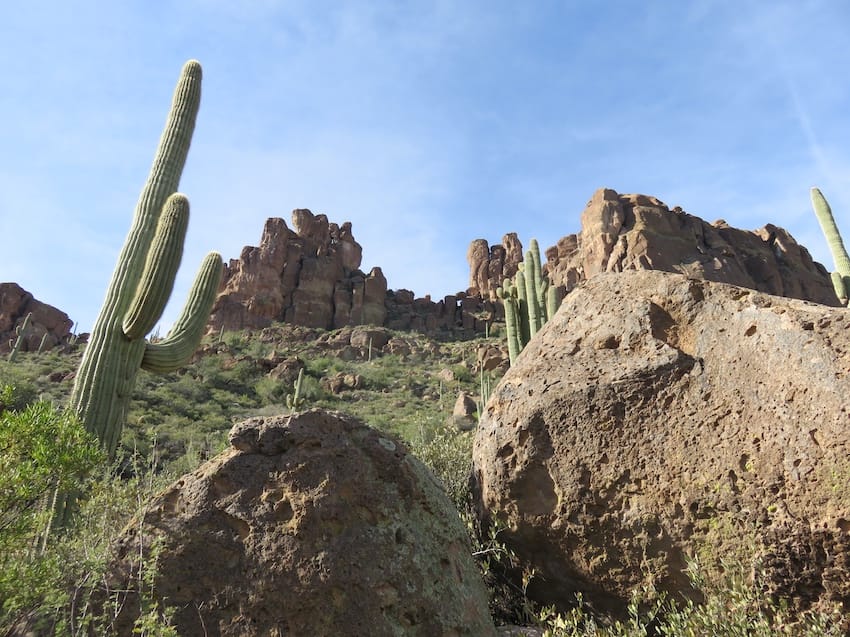 Saguaro cacti and rock formations in the Superstitions along the Bluff Springs trail.
While this history makes for spooky campfire stories, most modern-day adventurers are attracted to backpacking in the Superstition Mountains because of their readily accessible stunning wilderness. Located within an hour of Phoenix, they are just close enough to be convenient, yet their ruggedness keeps the crowds away.
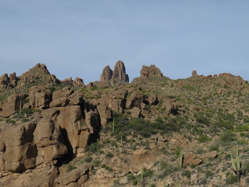 Weavers Needle in the center of the shot on the horizon.
When to go and what to expect when you’re backpacking the Superstition Mountains
The sparse network of lightly traveled and sometimes indistinct trails offers campers a challenging entry into the wilderness that is part of the Tonto National forest. Since the Superstition Mountains are in the Sonoran Desert, finding water is one of the key challenges during a hike. Springs in the area offer the only year-round water source, and having a guide is essential to knowing which springs are flowing sufficiently and their exact location. Going in the cooler and wetter winter months also makes for a much more pleasant experience; October thru April is recommended.
The pin on the Google map is the Superstition Mountains.
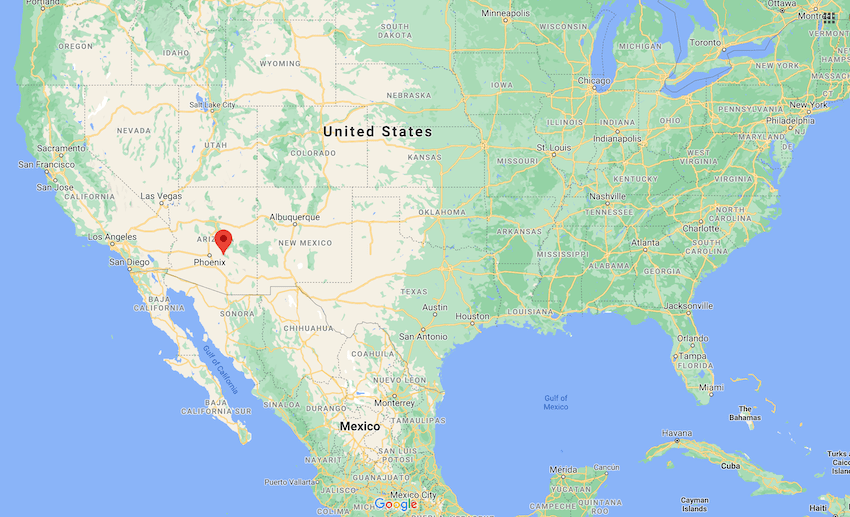 This map view provides a good context of where the Superstition Mountains are located.
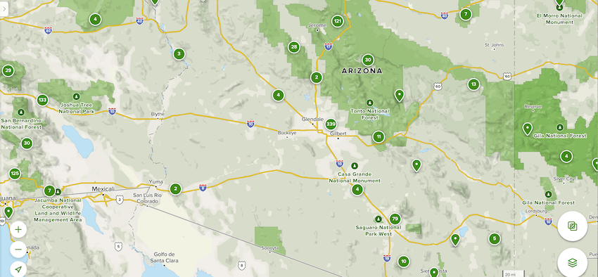 Superstition Mountains are located in Tonto National Forest.
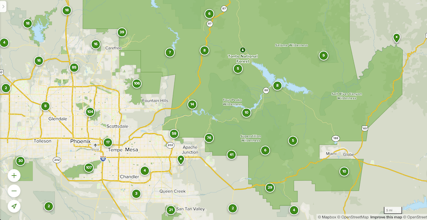 Here you can see the Superstition Wilderness is located in the Southern part of the Tonto National Forest.
A 2-night, 3-day Superstitions backpacking trip is the ideal length for getting a meaningful appreciation of the area.
The hikes each day are a manageable 6-8 miles in length, and while there is a good amount of ascent and descent, it is not crushing. The elevation is also mostly below 5,000 feet, so altitude sickness is not an issue. Spending the day hiking and exploring nature at a comfortable pace makes for a restful sleep under a night sky blanket of stars.
Frequently Sold Backpackers Packs Under $200
I picked 3 quality brands with 100% guaranteed packs at moderate price points that come with a manufacturer’s warranty. They all have adjustable shoulder harness systems and have the features you need. Most backpackers should be able to get a good fit with these packs.
Granite Gear Crown2 60 Pack – Men’s
REI size and color availability good ($199.95)
Granite Gear Crown2 60 Pack – Women’s
REI size and color availability good ($199.95)
Osprey Rook 65 Pack – Men’s
Official Osprey site ($165.00)
Osprey Renn 65 Pack – Women’s
Official Osprey site ($165.00)
REI Co-op Trailbreak 60 Pack – Men’s
REI availability good ($149.00)
REI Co-op Trailbreak 60 Pack – Women’s
REI availability good ($149.oo)
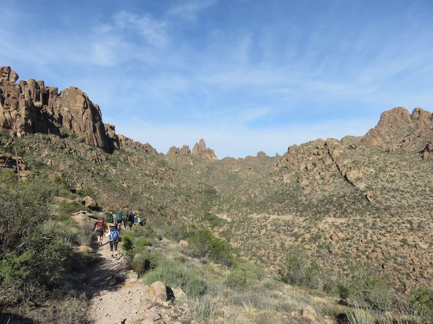 Group of backpackers on the Bluff Springs trail.
October thru April is the ideal time of year to go backpacking in the Superstition Mountains.
A group of 4 to 8 is a nice size, striking the right balance between personalized attention and creating a team spirit to carry group gear and dynamically share the adventure. As you plan your fall, winter, or spring wilderness getaway, do not overlook the Alps of the Sonoran Desert!
Details of my favorite Superstition Mountains backpacking itinerary
The typical itinerary is 2-nights and 3-days, and we do a big loop that links 4 trails together.
Day 1: We enter the Superstitions via the Peralta trailhead and hike a full day to a campsite at Charlebois Spring. Once there, we unpack, set up camp, and scavenge wood for our campfire.
We backpack on nearly all the trails in the image below. However, we continue on to Charlebois Spring as there is better camping there.
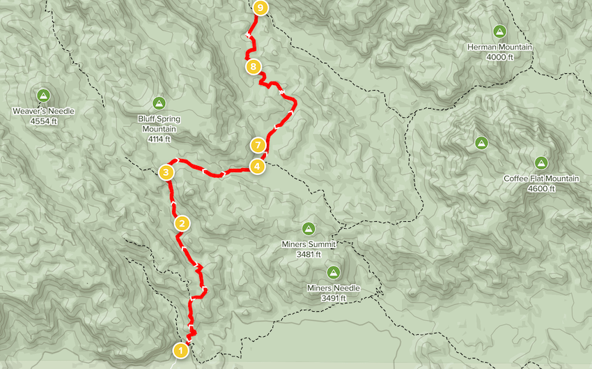 AllTrails map: 10.8 mile out and back Bluff Spring Trail to Dutchman Trail to Charlebois Canyon and Le Barge Springs.
Day 2: We hike through a remote part of the Superstitions to Second Water Spring and spend another night under the stars.
We do not complete the loop below, but instead camp at Second Water Spring. We hike to Second Water Spring via Dutchman’s Trail, Cavalry, and Boulder Creek trails.
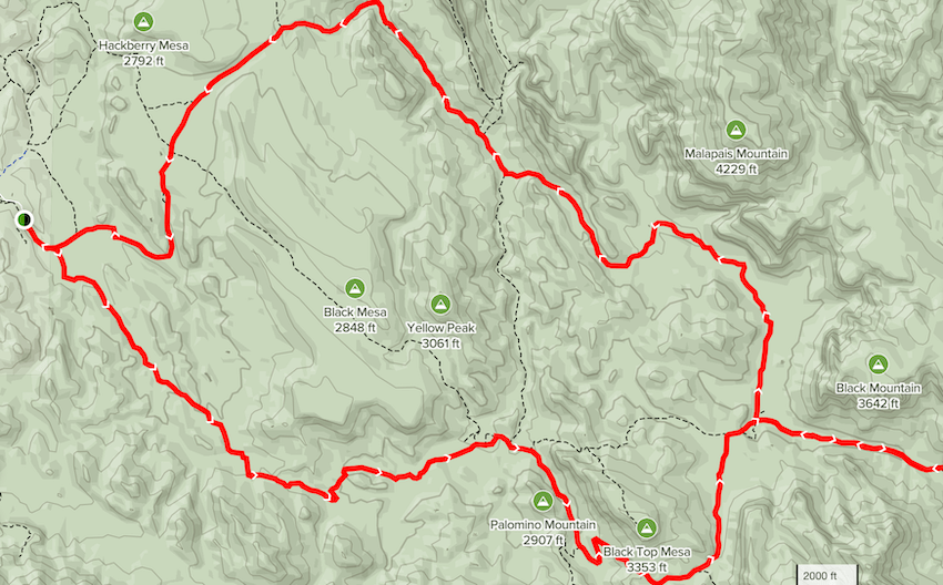 AllTrails map: Dutchman Trail #104 and Cavalry Trail #239 Loop is a 17.7 mile lightly trafficked loop trail.
Day 3: The longest hike is about 10 miles as we work our way back to the Peralta trailhead.
This loop below shows part of the system we use, the Dutchman’s and Terrapin trails. We hike from Second Water back to Peralta trailhead.
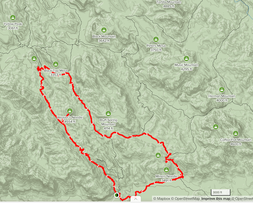 AllTrails map: Weaver’s Needle via Peralta Canyon, Dutchman #104, Terrapin #234 and Bluff Spring Loop is a 17.7 mile loop trail.
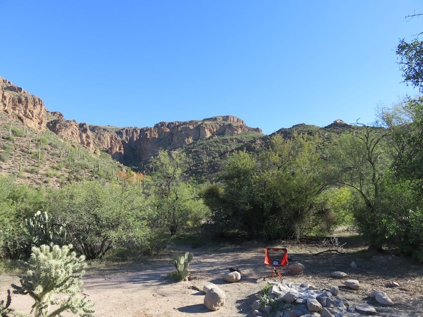 Night 1 camp site at Charlebois Springs.
The Superstition Mountains are in the Sonoran Desert, which offer an amazing diversity of plant and animal life.
The iconic Saguaro Cactus punctuates the mountain slopes as do a cornucopia of other succulents. Gila monsters, coyote, ring tail cats, bobcats, hawks, and a variety of lizards are the most often spotted animals.
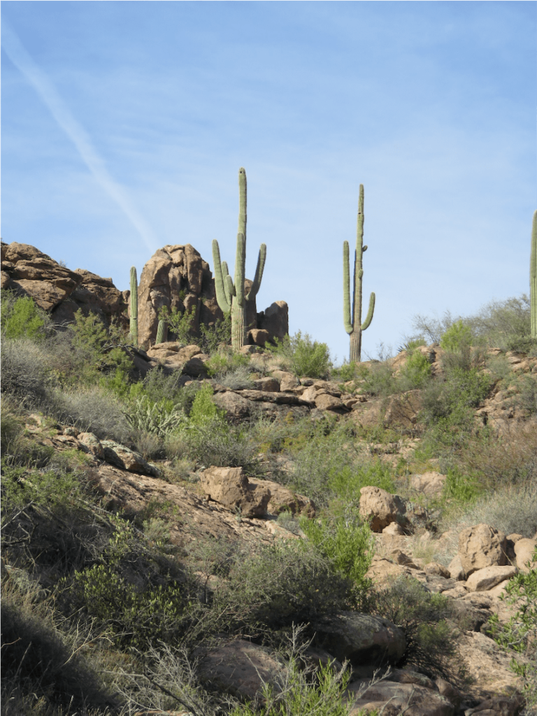 Saguaro Cactus punctuate the Superstitions landscape.
Frequently asked questions about backpacking in the Superstition Mountains
Are Superstition Mountains backpacking trips dangerous?
The Superstitions are dangerous in the sense that people are often unprepared and not acclimatized to the conditions, particularly the heat. When they run out of water or get disoriented, the wheels fall off pretty quickly and that’s when things turn ugly. More than 350 people have died over the years looking for the Lost Dutchman’s gold mine.
How long is the Superstition Mountains hike?
The average day of hiking is 8 miles. Our typical Superstition Mountains backpacking itinerary covers around 24 miles over the course of three days. This can be customized depending on your appetite for adventure.
Are the Superstition Mountains open for backpacking during the COVID-19 pandemic?
The Superstition Mountains are open and have remained open during the pandemic.
Can you camp in the Superstition Mountains?
Yes, camping is a popular activity in the Superstitions. Day hikes are the most common activity, but for the more adventurous, backpacking and camping are preferred. The area gets rugged pretty fast and because of the lack of water sources, which is why prior planning is key to having a positive experience.
Who found the Lost Dutchman Mine?
We reveal who found the mine and the legend behind it over the campfire each night. It’s a lengthy story with many players stretched over 250 years.
Can you drive to the top of Superstition Mountain?
No, you can’t drive in the mountains. It is all a wilderness area with no vehicular access.
How do you get to the top of Superstition Mountain?
We do not climb Superstition Mountain. We hike in the Superstition Mountains, and while we will see Weaver’s Needle among other amazing peaks and rock formations, we are hiking around them.
Who owns the Superstition Mountains?
The Superstition Mountains are public lands. They are within the Tonto National Forest and are largely designated as a wilderness area.
Is there gold in the Superstition Mountains?
There is gold in the mountains, but the Lost Dutchman’s Mine has never been found since the Dutchman died.
How difficult is the Flatiron hike?
Flatiron is a popular day hike in the Superstitions. It is pretty accessible from Phoenix. It is a very challenging hike with several scrambling and class 4 and 5 rock climbing sections.
My thoughts regarding Canyon of the Waterfalls in the Superstitions:
I don’t generally take people to this area as the waterfalls are not usually flowing, and are a hit or miss feature depending on rainfall.
What is dispersed camping Superstition Mountains?
Camping is generally dispersed in the vicinity of flowing springs. No official designated camp sites exist. Water is the key element for survival in the area when overnight backpacking in the Superstition Mountains.
What is the best view of Superstition Mountains?
There are amazing views throughout the Superstitions. Flatiron is popular because it overlooks the Superstitions to the north and east and the city of Phoenix to the west.
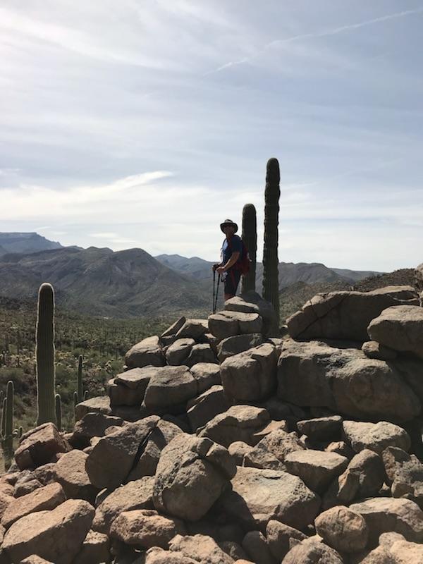 Will hiking in the Superstitions.
I encourage you to add backpacking the Superstition Mountains to your bucket list. It’s easy to get to if you live in the USA and you can knock off even more bucket list travel items along the way:
– Visit Arizona
– Check out Phoenix
– Visit the Tonto National Forest
Any questions about Superstition Mountain backpacking or camping, email me at will.burkhart@gmail.com and I’ll be happy to help in any way. Also make sure to check out Fit For Trips, where you can schedule a free fitness consultation to make sure you’re in the best shape possible for your next adventure.
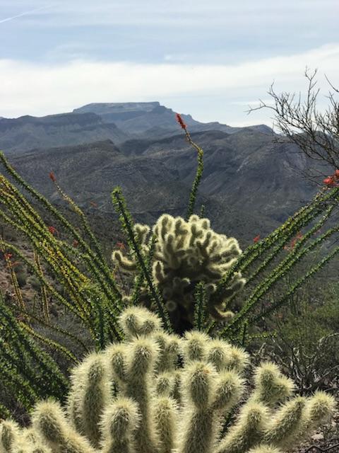 Teddy Bear Cholla cactus as well as some Ocotillo in bloom.
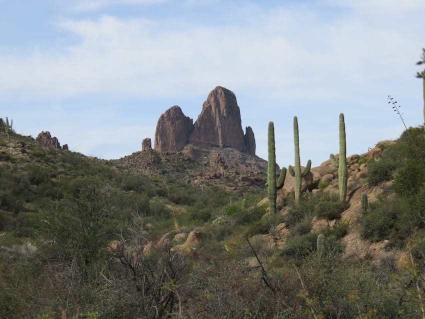 Miners Needle

Michael Young
Hello Will, my name is Mike Young, myself and three others are planning a 5 day backpacking trip in the Superstition Mts. Writing to you for a possible route and a guide book you would recommend for the area. We are planning for the second week in March. We are all experience hikers and range in age from 50 to 63. Any advise from you will be greatly appreciated. Thank you.
Marcus Shapiro
You guys are going to have a blast. I understand you need a little more guidance. At the top of the article you can find Will’s information and can contact him directly. Additionally you can check out this 2014 Falcon Guide book called Hiking Arizona’s Superstition and Mazatzal Country: A Guide to the Areas’ Greatest Hikes. Based on the summary it should satisfy your needs. It reads, “This guidebook contains descriptions of enjoyable hikes from a few hours to a week in length…” Here is the link https://amzn.to/42lpwnS
Alexandra G.B.
Hi Michael, what 5-day hike did you end up doing last March in the Superstition Mountains?
JackiW
Hi. I have one question. When backpacking the supes, where is a safe place to park for the two nights I am out there? Can you park at the Peralta TH overnight? What is your suggestion?
Thanks you!
Wayne Aune
Hi so did you do the trip? If so please tell me the route and anything else. I am not an experienced backpacker, but starting Canyon Lake over to Cavalry trail