Garmin Watches and Maps: What you Need to Know for Hiking
Searching online for the best Garmin watches for hiking? In this article we answer many questions about maps: free, Google, TOPO, OpenStreetMap. We also cover details about BaseCamp software. What good is a hiking watch if it does not have reliable map functionality to guide you from trailhead to summit and back? That’s an obvious answer…
Free shipping on all orders over $25 at Garmin.com!
Which Garmin watch is best for hiking?
Garmin features nearly half a dozen watch series that could be suitable for hiking. However, three of them stand head and shoulders above the rest of the pack.
#1 – Garmin Fenix 6 Series
The Garmin Fenix 6 series is top of the line, constantly updated/supported, and features everything you could want in a hiking watch. From preloaded basemaps to the option to have a screen capable of solar charging, this watch has it all. The Fenix 6 is ideal for those who want a premium tool to aid in their training and adventures.
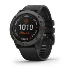 fēnix® 6X – Pro Solar Edition $949.99
“The Garmin Fenix 6 is like a Swiss Army knife for your wrist. It has so many tools and features that I never even knew I needed for my hiking… I do not think I could ever go back.” – Andrew, international backpacker.
The Fenix 6 has more customization options than any of its predecessors. You get to choose case size, from 3 different lens options, and if you want premium features (like ski maps and reloadable music).
LEAST EXPENSIVE Fenix 6 = $549 (CHECK PRICE: GARMIN)
CHECK OTHER GARMIN FENIX 6 HIKING WATCH MODELS: GARMIN / REI / ROAD RUNNER
To learn more about Garmins newest outdoor recreation-focused smartwatch, we interviewed Austin. Austin is an aspiring triathlete and backpacker who has relied on his Fenix 6 for virtually every part of his training. In his interview, he breaks down why the Fenix 6 was perfect for him and tells us about how it has upped his game. We also breakdown all of the optional features that are currently available on the Garmin Fenix 6.
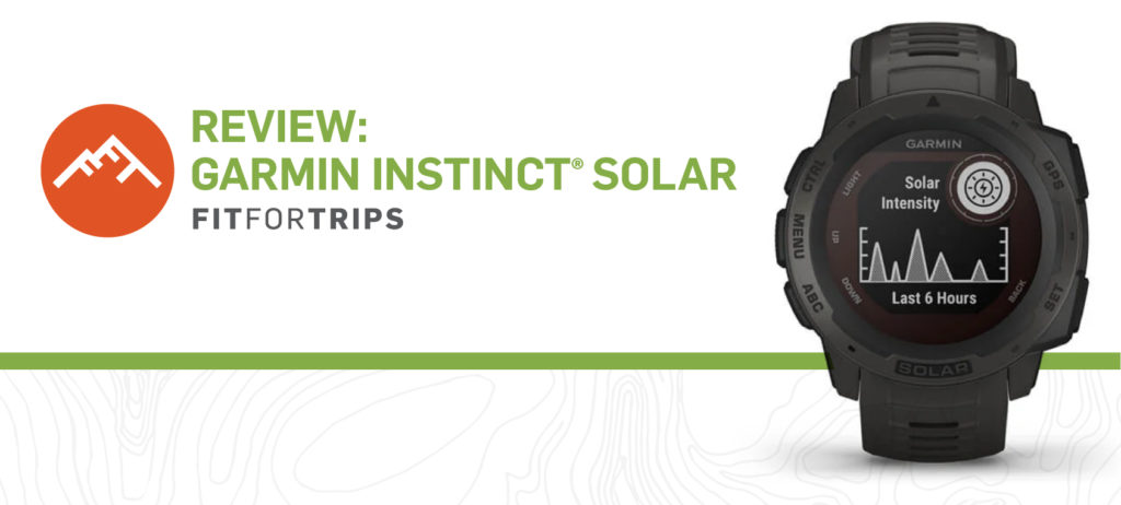
#2 – Garmin Instinct Series
While the Instinct does not feature TOPO maps (like its Fenix counterparts), it does feature route tracking and all of the activity tracking tools you could ask for. This makes it a good fit for those who are looking to navigate with a different tool (paper and compass/phone/other GPS device). The route tracking tool is the perfect backup in case your other forms of navigation fail you. With the Instinct you can always find your way home.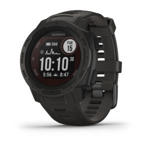 Instinct® Solar $399.99
“I love my Garmin Instinct. I can track my hikes, download other people’s hikes and use the GPS. It is easy to use and the battery lasts for quite a while.” – Jack, avid backpacker and hiker.
The Instinct features a variety of options for a buyer to choose from. You can choose if you want a solar energy capturing lens, what special activity-focused edition you want, and pick from a variety of colors.
LEAST EXPENSIVE Instinct = $299 (CHECK PRICE: GARMIN)
CHECK OTHER GARMIN INSTINCT SMARTWATCH MODELS: GARMIN / REI / ROAD RUNNER
Register your device on Garmin.com and receive a 10% discount code for future accessory purchases!
Interest in learning more? We interviewed hardcore backcountry explorer Seth in early 2021 to learn more about the Instinct. Check it out to learn more about why he chose the Instinct, what edition he has, and how it has helped him in the backcountry.
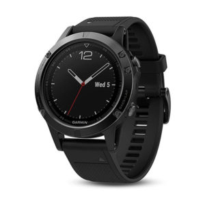
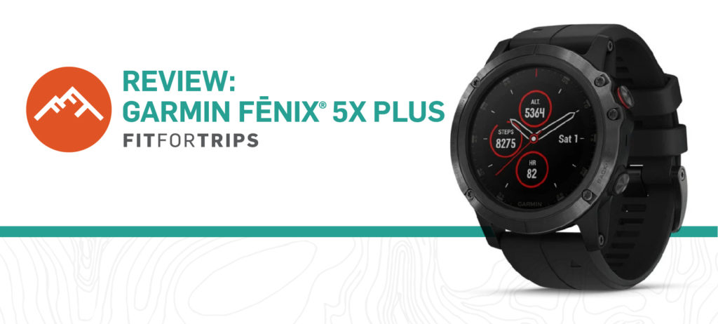
#3 – Garmin Fenix 5 Series
While older, and somewhat less sophisticated than the Fenix 6, the Fenix 5 series still features professional-grade features. However, it has the advantage of coming in at a more introductory price point. Meaning that this watch is perfect for those who are just starting out in trail running, backpacking, or who are just looking for a more training-focused smartwatch than what the competitors have to offer.
“As a new trail runner, and self-proclaimed terrible navigator, my Fenix 5 has kept me from getting lost on more occasions than I can count. I would literally be lost without it. The reduced pricepoint made it the perfect get as somebody new to the sport” – Alexa, avid backpacker and hiker.
The Fenix 5 sports the same S/Base/X sizing system as its successor. To add to the customization, you can also choose if you want to tack on Pulse Ox Acclimation and choose from a variety of colors/patterns.
CHECK OUT FENIX 5 HIKING WATCH MODELS: AMAZON
Despite being the older model, plenty of people are still getting incredible amounts of value out of their Fenix 5s. To learn more about why, we interviewed Bobby. Bobby has hiked all across the world due to his time in the Navy and has really put his Fenix 5 through the ringer. To learn more for yourself, check out our full interview with him.
Which Garmin watches have topographic maps?
Virtually all Garmin watches, maps are included in some capacity. The biggest difference is whether the watch has (1) route tracking, (2) Open Street Maps, or (3) Garmin TOPO maps. While the other functionalities are useful, other map and route tracking features are not an adequate substitute for the Garmin TOPO series of topographic maps when in the backcountry.
Garmin’s TOPO maps will provide you with significantly more information to stay safe, avoid rescue, and know exactly where you are going when in the wilds.
The following watches feature Garmin TOPO maps:
- Fenix 6
- Fenix 5
- MARQ Adventurer
Does the Garmin Vivoactive watch 3 have maps?
The Garmin hiking watches that support background maps are those that run the 2.0 version of Garmin Connect IQ and allocate 128kB of memory to each app: Garmin Vivoactive HR and Vivoactive 3 and higher.
Does Garmin Connect show maps?
Garmin Connect is a platform that’s all about helping you stay in shape, giving you ways to make the most of your exercise, or simply keeping closer tabs on your health. For hikers using maps, adding routes, tracks, points of interest and waymarks, Garmin BaseCamp is the program to use on your hiking watch.
Garmin Connect can only display a map in an activity if it was recorded with GPS location information – for instance, your daily walking or running route. Activities that do not contain GPS information, such as activities created with a Vivofit or activities recorded in an indoor profile or with GPS disabled, will not have a map.
Are Garmin TOPO maps any good for hikers?
These highly detailed Garmin hiking maps include terrain contours, topo elevations, summits, routable roads and trails, parks, coastlines, rivers, lakes and geographical points. They can also display 3-D terrain shading on compatible devices. The detail is on par with USGS topographic maps.
Do Garmin TOPO maps show hiking trails?
Garmin TOPO maps feature topographic detail with terrain contours, searchable points of interest and turn-by-turn directions on roads and trails. Popular trails are typically shown, but not every trail has been mapped.
https://buy.garmin.com/en-US/US/c456-p1.html – Add TOPO maps to your Garmin hiking watch to guide you on your next adventure.
How can I get Garmin maps for free?
Install free maps on your Garmin hiking watch which are sourced from Open Street Maps. These are fine for finding your way around town or driving, but do not have the level of terrain detail the Garmin TOPO series of maps have.
How to download free maps for a Garmin GPS: step-by-step instructions
Step 1: Go to Open Street Map Website: http://garmin.openstreetmap.nl
Step 2: Choose your map type. Click “generic routable (new style)”
Step 3: You have two choices at this point; you can download a pre-defined country or build your own custom map covering the area you need.
What map format does Garmin use?
GPX data files have long been a GPS standard for waypoints, points of interest, routes and tracks, and other information added to a basemap.
Garmin cannot use Google Earth KML (and KMZ, compressed KML files) files, but points of interest and routes on Google Earth can be converted to GPX files to use on Garmin and other GPS devices or programs via Garmin BaseCamp software.
There are several free web-based programs that can convert KML/KMZ files to or from GPX files:
Converting Google KML files to GPX for use on your Garmin device:
- Access your My Map in Google Earth. Your My Map must have lines or routes in it.
- Click on View in Google Earth.
- Visit one of the conversion websites below to convert your KML file to GPX.
- Select GPX as your output.
- For the input, choose the KML file you just downloaded from Google My Maps.
- Click Convert.
- Download your GPX file from the link on the page.
https://kml2gpx.com/ – This is an easy-to-use program that’s fairly intuitive.
https://mygeodata.cloud/converter/kml-to-gpx – Also an easy-to-use program that’s fairly intuitive.
https://www.gpsvisualizer.com/convert_input – This program can do a lot but it’s not intuitive; it’s more for map nerds and experts.
How do I use Garmin BaseCamp for hiking?
With Garmin BaseCamp software on your computer, users can plan and manage hiking trips, organize user data, and transfer information between the computer and compatible Garmin GPS devices:
- Import and view maps in 2-D or 3-D (preloaded device, memory card, or download required)
- Create, edit, and organize hiking routes, tracks, waypoints, and more
- Download and transfer BirdsEye satellite imagery to a device (subscription required)
- Get support for importing downloaded geocaches from Geocaching.com
- View playback of hiking routes, tracks, and adventures
- Create and share geotagged photos
Can I put Google Maps on my Garmin watch?
Not directly. Google uses KML files, Garmin use the GPS standard GPX files. You can import KML files into Garmin BaseCamp software that you can select and directly import an existing track (on the map) to any Garmin watch that supports Tracks. See more under “What map format does Garmin use“. This assumes you are using a Garmin map compatible watch.
Install free maps on your Garmin watch
https://richjenks.com/google-maps-to-garmin/
How do I get free Garmin map updates?
Go to http://my.garmin.com and log onto your myGarmin account. Notifications appear in the Home tab that inform you of recently purchased map updates and available free updates.
How does Garmin calculate Vo2 max?
Garmin is using Firstbeat software technology to calculate the Vo2max.
As the Vo2 max is calculated from your heart rate it will take a week or two of activity tracking before you see a stable number for your Vo2Max score. Also, since it’s just an estimate rather than a direct measure, it’s best to use it as a trend line instead of an absolute measurement of fitness.
The Vo2Max calculation is highly dependent on your heart rate and the accuracy is dependent on having an accurate MaxHR (maximum heart rate) number in your Garmin device profile. An accurate number is based on your physiology and fitness. It is not the same as the standard 220 BPM (beats per minute) minus your age that will automatically be generated for you when you set up your account.
On the Garmin Support Center website you can read a simple method that answers this question: How can I determine my max heart rate? However, you need to be in good shape to perform their recommended test. If it’s not safe for you to exert yourself maximally, then you will rely on the default MaxHR automatically generated on your Garmin hiking watch.
How does Garmin measure stress?
If using only a Garmin watch, the accuracy is quite good. When you track hiking or other activities using another Garmin device (i.e. cycling with an Edge bike computer) the number will not be accurate because Garmin Connect doesn’t use the data it holds from the watch to associate the increased heart rate with exercise rather than stress.
Is an Apple watch better than a Garmin watch for hiking?
People who love hiking, trail running and the great outdoors need a reliable GPS watch that provides navigation features and a long battery life for multi-day adventures. In general, Garmin hiking watches are built for rugged outdoor use in a variety of weather conditions. Altitude/elevation, barometric pressure, compass and route tracking are common to Garmin watches. Apple did not add a barometric altimeter (elevation gain or loss) to their watch until Series 3 and later, so those watches should be fine for hiking, though are not built for ruggedness, i.e. scratched or broken glass screen.
Also note the typical hours of usage for one battery charge. Generally, Garmins have much higher battery capacity and can go for many days without recharging. The Apple Series 6 is rated for 18 hours on one charge. By comparison, the Garmin Fenix 5 operating in GPS UltraTrac mode is rated for 75 hours.

Rob S.
For those that are looking to make hiking more of a constant activity in 2021, these are great watches to have. A few options are available and they provide great functionality for the investment they call for, too.